
Welcome to CivilGEO Knowledge Base
Welcome to CivilGEO Knowledge Base
In CivilGEO software, the Trim Polylines command cuts and deletes selected portions of one or more selected polylines at the intersection with a drawn polyline or selected polyline.
Note that this command can only be used for the drawing elements. It cannot be used for the HEC-RAS and HEC-HMS entities.
The following examples illustrate how the Trim Polylines command can be used to trim the selected portions of the polylines.
Example 1
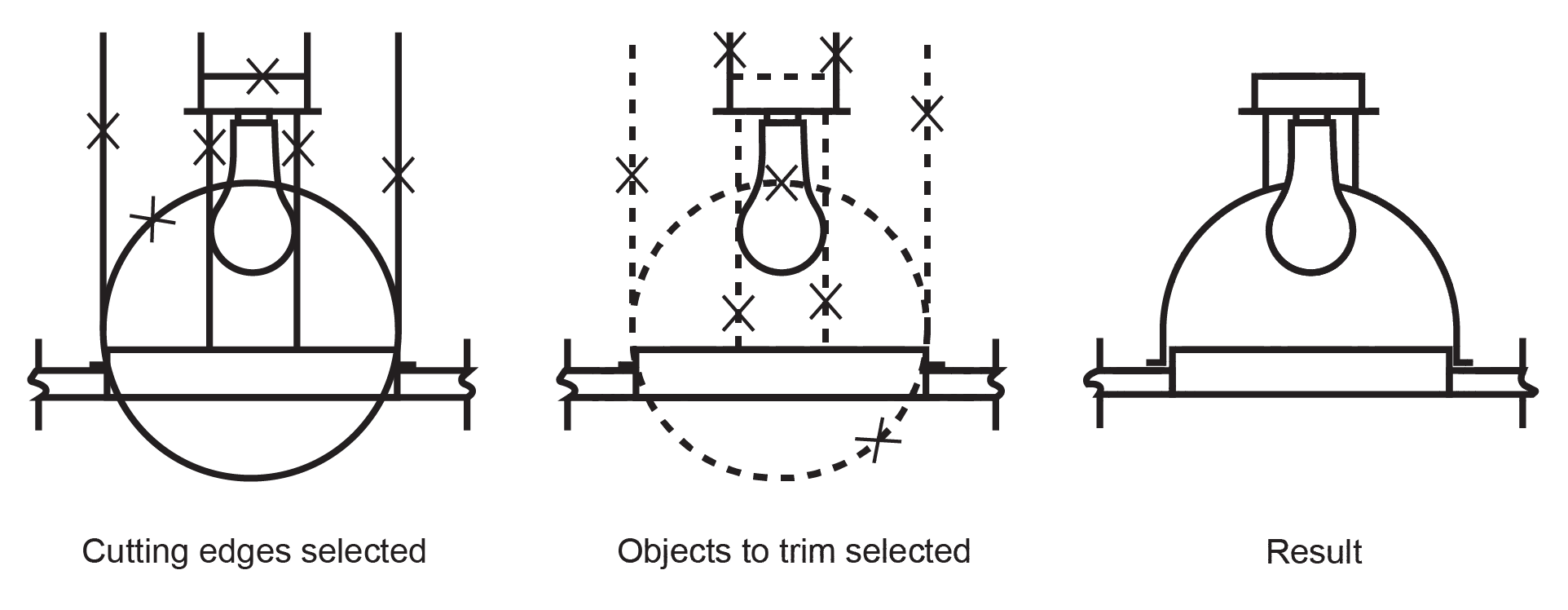
A polyline can be one of the trimming polylines and one of the polylines being trimmed. In the following light fixture example, the circle is a trimming polyline for the construction polylines and is also being trimmed.
Example 2
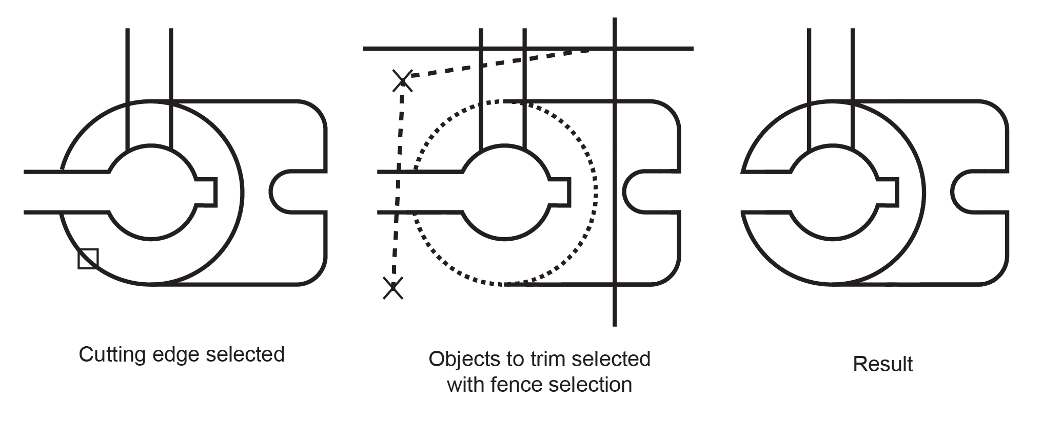
When trimming several objects, the different selection methods can assist the user in choosing the trimming polylines and polylines to trim. In the following example, the trimming polylines are selected using a crossing selection.
Example 3
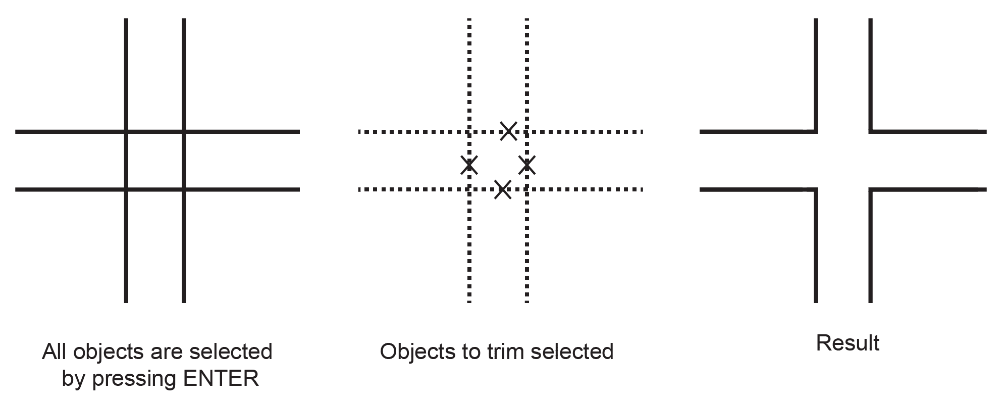
Polylines can be trimmed to their nearest intersection with other polylines. In the following example, walls are trimmed so that they intersect smoothly.
This article explains how to use the Trim Polylines command in CivilGEO software.
From the Map Edit ribbon menu, select the Trim Polylines command and the Trim Polylines dialog box will be displayed.
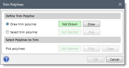
The following sections describe how to use the Trim Polylines command and interact with the above dialog box.
The Define Trim Polyline section allows the user to define a polyline that should be used in the Trim Polylines command. The user can define a polyline to be trimmed by either drawing a new trim polyline or by selecting the previously drawn polyline from the Map View.
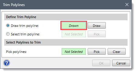
The Draw trim polyline radio button option allows the user to interactively draw a single trim polyline on the Map View.
Follow the steps below to draw a trim polyline on the Map View:
![[Draw] button](/wp-content/uploads/sites/25/2023/12/Trim-Polylines-Command-Image-5.png)
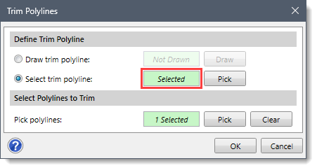
The Select trim polyline radio button option allows the user to select an existing polyline from the Map View as a trim polyline. Note that only one polyline can be selected at a time.
Follow the steps below to select a trim polyline from the Map View:
![[Pick] button](/wp-content/uploads/sites/25/2023/12/Trim-Polylines-Command-Image-7.png)
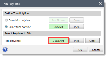
The Select Polylines to Trim section allows the user to manually select the existing polylines to be trimmed from the Map View. Note that this section is enabled only when the user has defined a trim polyline in the Define Trim Polyline section.
Follow the steps below to select polylines to be trimmed:
![[Pick] button](/wp-content/uploads/sites/25/2023/12/Trim-Polylines-Command-Image-9.png)
 Note that if polylines have been preselected before running this command, the same number of selected polylines will be displayed in the Pick polylines read-only field.
Once the options have been properly defined in the Trim Polylines dialog box, click the [OK] button.
![[OK] button](/wp-content/uploads/sites/25/2023/12/Trim-Polylines-Command-Image-11.png)
A prompt will be displayed on the status bar instructing the user to select the side of the polylines to be trimmed (i.e., removed). After clicking on a polyline, the side that is clicked on will be displayed in a red color. Now, press the [Enter] key or right-click and select Done from the displayed context menu. The selected polylines will be trimmed to the specified cutting edges.


CivilGEO G2 Reviews
4.8/5.0 Rating, Over 230 Reviews

GeoHECRAS is recognized as the top Civil Engineering Design Software with an average of 4.8 out of 5.0 rating from over 230 real user reviews on G2.


We use cookies to give you the best online experience. By agreeing you accept the use of cookies in accordance with our cookie policy.
When you visit any web site, it may store or retrieve information on your browser, mostly in the form of cookies. Control your personal Cookie Services here.


