
Welcome to CivilGEO Knowledge Base
Welcome to CivilGEO Knowledge Base
CivilGEO’s software helps engineers create hydrology projects with eye-catching details, making them easier to understand, analyze, and present, giving them an edge over competitors. By using OpenGL’s powerful features, our software produces stunning graphics, making the project design process more exciting. OpenGL is a widely adopted 2D and 3D graphics API (Application Programming Interface) that is used to create high-performance graphics software applications in fields such as CAD (Computer Aided Design), game development, virtual reality, etc.
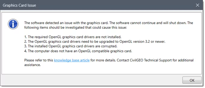
When you start up CivilGEO software, you might encounter an unusual error caused by incorrect initialization of OpenGL as shown below, which relies on your graphics card’s driver package.
 This type of error usually occurs when the graphics or display card of the computer does not meet the minimum requirements for operating CivilGEO software. Refer to this article in our knowledge base to learn more about minimum software system requirements.
However, the user may find the above error misleading/false, even if their computer’s graphics card meets the software’s system requirements. This error message displayed in this scenario may occur due to corrupted OpenGL drivers associated with the graphics card.
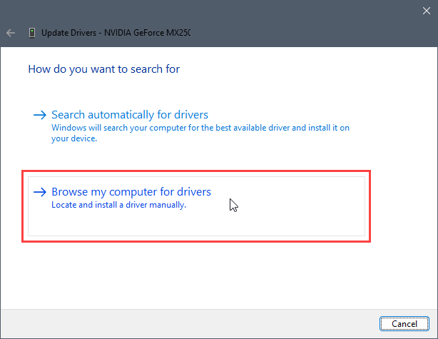
To fix the corrupted OpenGL graphics drivers, follow the below troubleshooting steps:
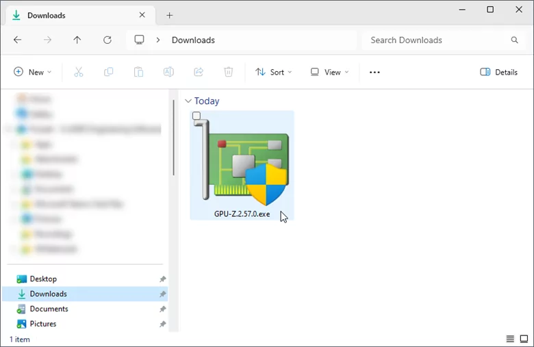
![Click on the [Download] button](/wp-content/uploads/sites/25/2024/03/Troubleshooting-Graphics-Driver-for-OpenGL-Image-2.png)
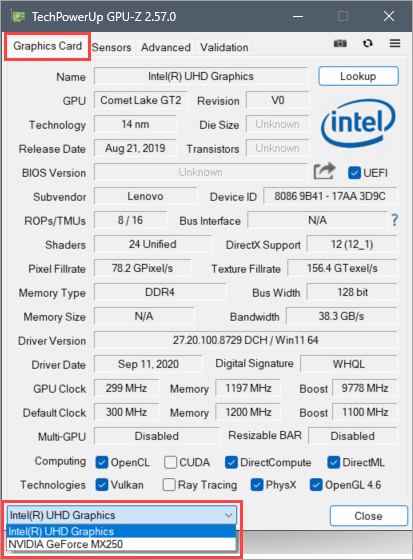
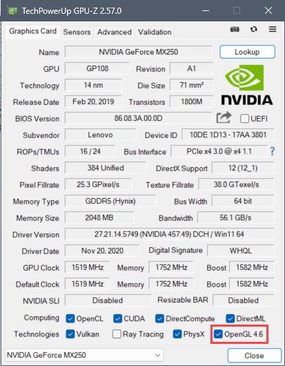
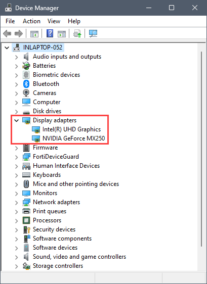 Note: By default, the CivilGEO software is programmed to utilize the graphics card of the higher configuration to manage OpenGL without any compatibility issues. The configuration of the graphics card can be viewed in the GPU-Z utility in Step 2.
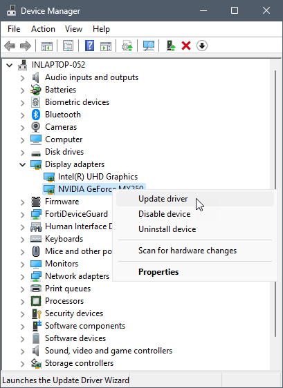
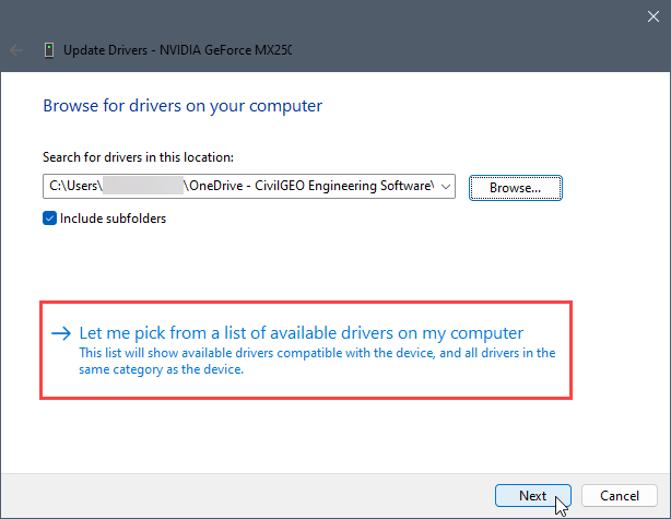
![Click on the [Next] button](/wp-content/uploads/sites/25/2024/03/Troubleshooting-Graphics-Driver-for-OpenGL-Image-11.png) Note: The number of drivers can differ depending upon the graphics card specifications.
Note: The number of drivers can differ depending upon the graphics card specifications.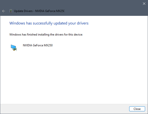
If you are still encountering issues, contact CivilGEO technical support. They will be glad to assist you further.


CivilGEO G2 Reviews
4.8/5.0 Rating, Over 230 Reviews

GeoHECRAS is recognized as the top Civil Engineering Design Software with an average of 4.8 out of 5.0 rating from over 230 real user reviews on G2.


We use cookies to give you the best online experience. By agreeing you accept the use of cookies in accordance with our cookie policy.
When you visit any web site, it may store or retrieve information on your browser, mostly in the form of cookies. Control your personal Cookie Services here.


