
Welcome to CivilGEO Knowledge Base
Welcome to CivilGEO Knowledge Base
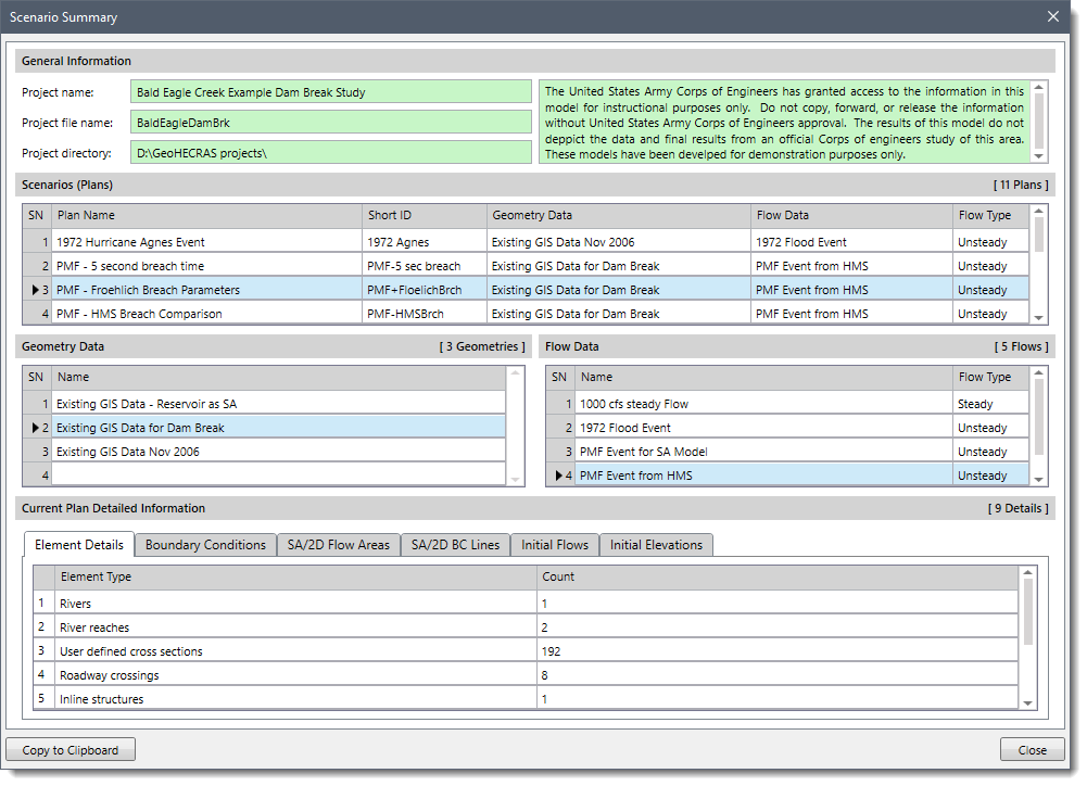
The Scenario Summary command in GeoHECRAS displays an informational dialog box that provides a detailed overview of the project: number of scenarios (plans), number of geometry definitions, number of flow definitions, and details of the current plan (such as element details, boundary conditions, defined flows, and storage area elevations).
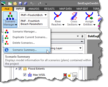
Follow the steps below to use the Scenario Summary command:
The below sections describe the information displayed in the Scenario Summary dialog box.
This section displays the project name (Project name), the project run file name (Project file name), and the directory path for the project (Project directory). The text area on the right displays the project description added by the user.
This section displays all the scenarios (plans) within the project, including the associated geometry data, flow data, and flow type in a tabular form. The current scenario of the project is shown highlighted.
This section displays the list of all the geometry data contained within the project. The geometry data associated with the current scenario is shown highlighted.
This section displays the list of all the flow data contained within the project. The flow data associated with the current scenario is shown highlighted.
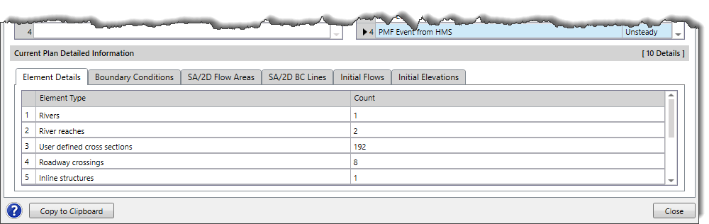
This section provides detailed information on the current scenario, such as element details, boundary conditions, defined flows, and storage area elevations.
The Elements Details panel displays the count of all HEC-RAS elements (river reaches, cross sections, roadway crossings, 2D elements, etc.) contained within the model.
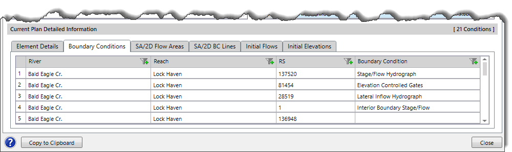
The Boundary Conditions panel displays the boundary condition type defined at each river station.
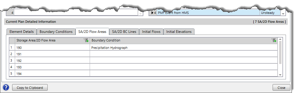
The SA/2D Flow Areas panel displays any storage areas and 2D flow areas contained within the model.
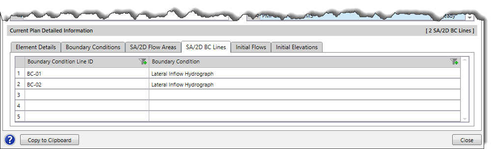
The SA/2D BC Lines panel displays the boundary condition type define at each Boundary Condition Line drawn along a storage area or 2D flow area.
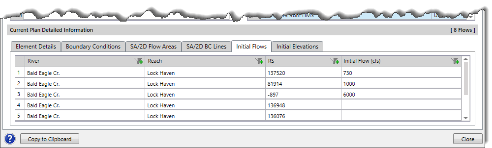
The Initial Flows panel displays the initial flow defined for any river station.
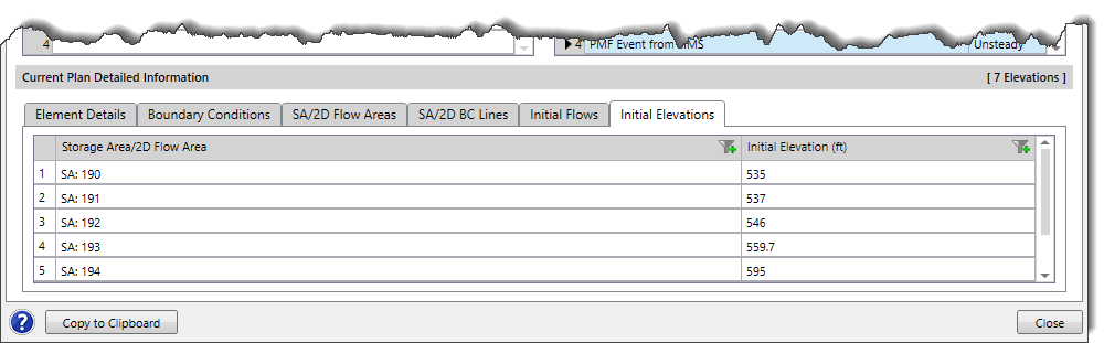
The Initial Elevations panel displays the initial elevation of all storage areas and 2D flow areas contained within the model.
Note that by clicking the [Copy to Clipboard] button, the user can copy the entire content of the Scenario Summary dialog box to the Windows clipboard and then paste it into a text file.


CivilGEO G2 Reviews
4.8/5.0 Rating, Over 230 Reviews

GeoHECRAS is recognized as the top Civil Engineering Design Software with an average of 4.8 out of 5.0 rating from over 230 real user reviews on G2.


We use cookies to give you the best online experience. By agreeing you accept the use of cookies in accordance with our cookie policy.
When you visit any web site, it may store or retrieve information on your browser, mostly in the form of cookies. Control your personal Cookie Services here.


