
Welcome to CivilGEO Knowledge Base
Welcome to CivilGEO Knowledge Base
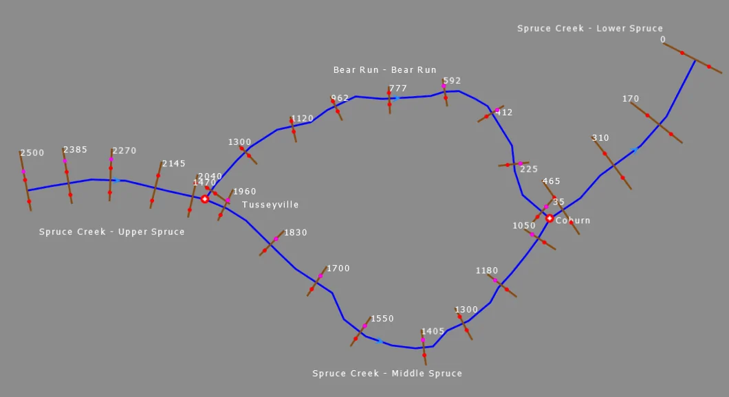
The river flow direction is defined by digitizing the river reach in a downstream direction. The software will display a flow directional arrow at the center of the river reach showing the assigned flow direction.
If the river reach is defined in an incorrect direction, either right-click on the river reach and select Reverse River Reach from the context menu or go to Input | River Reaches and then select the Reverse River Reach command.
The Reverse River Reach dialog box will be displayed. This dialog box gives the user the option to renumber the cross-section river stations.
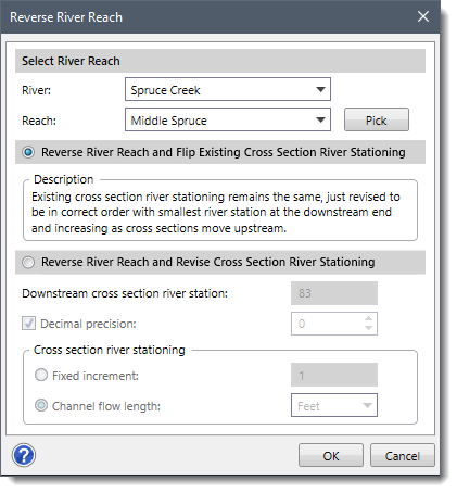
The following sections describe the Reverse River Reach command and how to interact with the above dialog box.
The Select River Reach section is used to select river and reach segments available in the project. The River and Reach dropdown entries display the selected river and reach. The user can click the [Pick] button to interactively select the river reach from the Map View.
This radio button option allows the software to reuse the existing cross section river stationing by simply reversing the cross section. In this way, the river stations will be in the correct order with the smallest river station at the downstream end and then progressively increasing in order as cross sections move upstream.
This radio button option allows the user to control the cross section river stationing by defining the starting (downstream most) cross section river station, and then identifying the cross section river station increment values as they move upstream.
The following options are available:
Once the options are defined, click the [OK] button, and the software will reverse the direction of the selected river reach.


CivilGEO G2 Reviews
4.8/5.0 Rating, Over 230 Reviews

GeoHECRAS is recognized as the top Civil Engineering Design Software with an average of 4.8 out of 5.0 rating from over 230 real user reviews on G2.


We use cookies to give you the best online experience. By agreeing you accept the use of cookies in accordance with our cookie policy.
When you visit any web site, it may store or retrieve information on your browser, mostly in the form of cookies. Control your personal Cookie Services here.


