
Welcome to CivilGEO Knowledge Base
Welcome to CivilGEO Knowledge Base
The Initial Conditions Flow Optimizations command is used to optimize (or balance) the split of flow at stream junctions, lateral structures, pump stations, and upstream boundary storage areas during the initial backwater computations in order to establish reasonable initial conditions for unsteady flow computations. This command is used for unsteady flow computations and is disabled for steady flow computations.
Follow the steps below to use the Initial Conditions Flow Optimizations command:
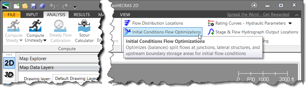
The following sections describe how to use the Initial Conditions Flow Optimizations command and interact with the above dialog box.
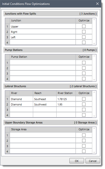
This section lists all junctions contained within the model that have flow splits. To have the software optimize the flow split at a junction, check the Optimize checkbox corresponding to that junction. Otherwise, leave it unchecked. By default, the checkboxes are left unchecked.
Flow optimizations at junctions are performed by computing the water surface profiles for all of the reaches, then comparing the computed energy gradelines for the cross sections just downstream of the junction. If the energy gradeline elevation in all the reaches below a junction is not within a specified tolerance (0.02 feet), then the flow to each reach is redistributed, and the profiles are recalculated. This methodology continues until the energy gradeline elevations are balanced.
This section lists all of the locations where pump stations are connected to the main rivers. To have the software optimize the flow split between the main river and the pump station, check the Optimize checkbox corresponding to that pump station. Otherwise, leave it unchecked.
Refer to this article in our knowledge base to learn more about pump stations.
This section lists all lateral structures contained within the model. To have the software optimize the flow split between the main stream and the lateral structure, check the Optimize checkbox corresponding to that lateral structure. Otherwise, leave it unchecked.
For the first iteration of the flow split optimization, the software assumes that zero flow is going out of the lateral structure. Once a water surface elevation profile has been computed, the software will compute flow over the lateral structure. It will then iteratively reduce the flow in the main channel until a balance is reached between the main stream and the lateral structure.
Refer to this article in our knowledge base to learn more about lateral structures.
This section lists all the storage areas located at upstream boundaries to the river reaches.
Note that only those storage areas that are at the upper end of a river reach with no other reaches feeding into them are listed. Storage areas that are in the middle of a model, at the downstream end of a model, or adjacent to a reach are not listed.
In order to have the software optimize the amount of flow coming out of the storage area based upon the user-specified storage area’s initial water surface elevation, check the Optimize checkbox corresponding to that storage area. Otherwise, leave it unchecked.
When the required options have been selected in the dialog box, click the [OK] button. The software will optimize (or balance) the flow split at the selected locations.


CivilGEO G2 Reviews
4.8/5.0 Rating, Over 230 Reviews

GeoHECRAS is recognized as the top Civil Engineering Design Software with an average of 4.8 out of 5.0 rating from over 230 real user reviews on G2.


We use cookies to give you the best online experience. By agreeing you accept the use of cookies in accordance with our cookie policy.
When you visit any web site, it may store or retrieve information on your browser, mostly in the form of cookies. Control your personal Cookie Services here.


