1. Home
  2. Knowledge Base
  3. GeoHECHMS
  4. FEMA Flood Data Command
  1. Home
  2. Knowledge Base
  3. GeoHECRAS
  4. FEMA Flood Data Command
  1. Home
  2. Knowledge Base
  3. Map Data Layers Panel
  4. FEMA Flood Data Command
  1. Home
  2. Knowledge Base
  3. Map View
  4. FEMA Flood Data Command

FEMA Flood Data Command

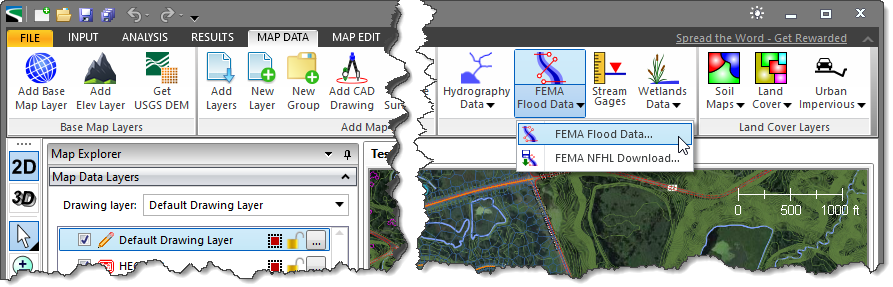
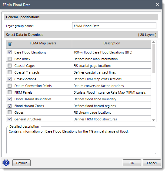
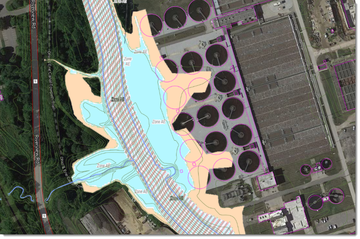
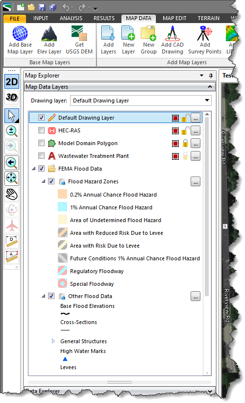
CivilGEO software can display the FEMA digital Flood Insurance Rate Map (FIRM) directly on the Map View. The Map View must be assigned a coordinate reference system so that the FEMA digital FIRM map can be correctly georeferenced to match the map coordinates.

Refer to this article in our knowledge base to learn how to assign a coordinate reference system to a project.

The FEMA digital FIRM map contains the following data:
  • Flood Hazard Zones & Boundaries
  • Flood Structures (i.e., roadway crossings, dams, etc.)
  • Levees
  • Base Flood Elevations (BFE)
  • Cross Sections
  • High Water Marks
  • River Mile Markers and more…

Note that this command works only within the United States.

Follow the steps below to display the FEMA digital FIRM map on the Map View:

  1. From the Map Data ribbon menu, click the FEMA Flood Data dropdown menu and then select the FEMA Flood Data command.
    FEMA Flood Data Map Data ribbon menu command
  2. The FEMA Flood Data dialog box will be displayed.
    FEMA Flood Data dialog box
  3. In the General Specifications section, the default layer group name is FEMA Flood Data and can be changed by the user.
  4. In the Select Data to Download section, the user can choose the FEMA map layers to download. Every FEMA map layer consist of a corresponding short description under the Description column. The user can use the provided default selection as these are typical layers used. However, the user can also experiment with various options to customize which FEMA map layers should be downloaded.
    To return to the default settings, click the [Default] button.
  5. When options have been properly defined, click the [OK] button. The software will download and display the FEMA flood map on the Map View.
    FEMA Flood Map
  6. As you zoom and pan about, the FEMA flood map will automatically update to fill the extent of the Map View display.
  7. After the FEMA flood data has been downloaded, the software will then place and identify the FEMA Flood Data layer as a new group in the Map Data Layers panel. The FEMA Flood Data layer will contain a legend detailing the contents of the displayed FEMA flood map. Expand the group to see the details of the loaded layers.
    FEMA Flood Data Map Layer

About the Author Chris Maeder

  • Was this helpful?
  • YesNo

Was this article helpful?

Related Articles