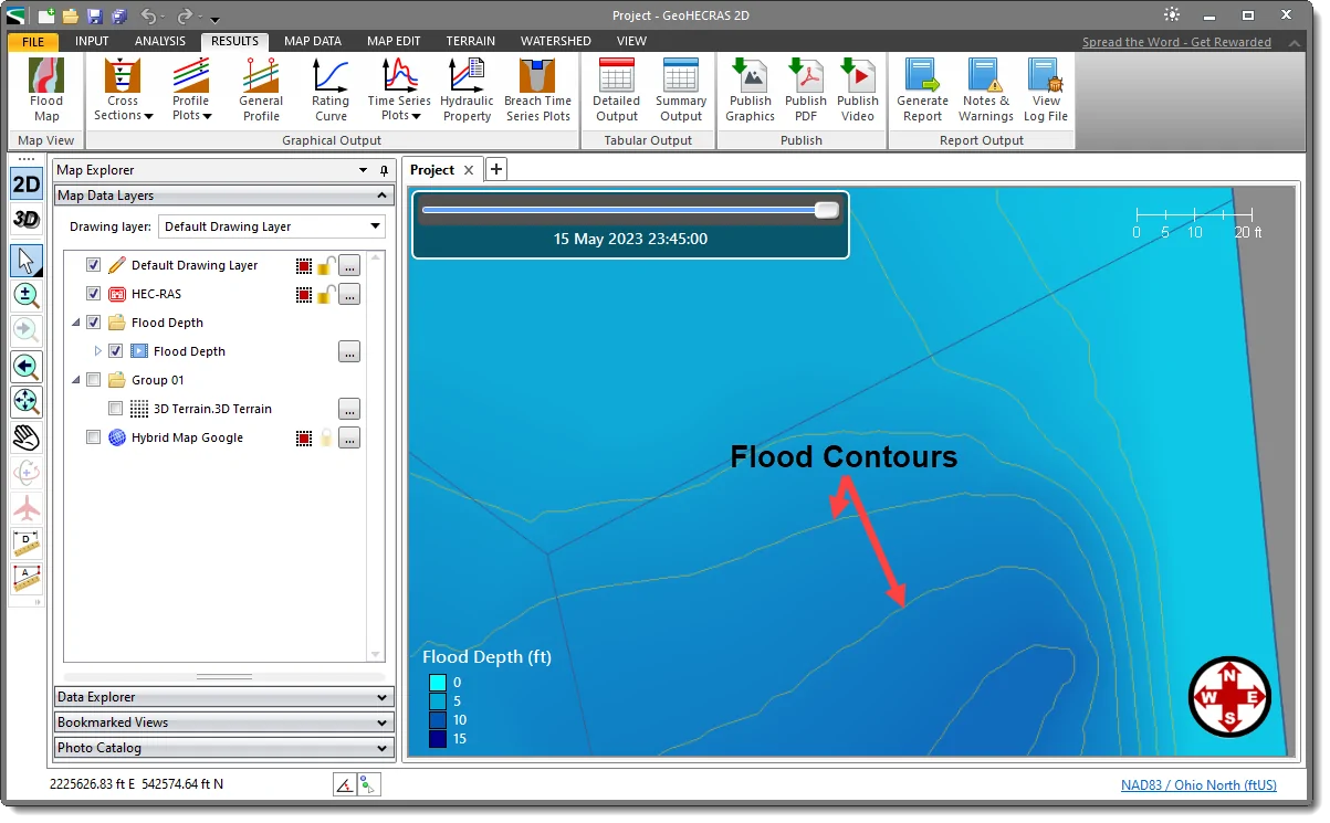
The Flood Map command can be used to create equally spaced Base Flood Elevation (BFE) contour lines for the generated flood map. These elevation contours help the user to capture the flow area most effectively during floods. Refer to this article in our knowledge base to learn how to create flood maps for 1D and 2D projects.
Creating Flood Map Contours for 1D Steady/Unsteady Projects
Follow the steps below to create flood contours for 1D steady/unsteady projects:
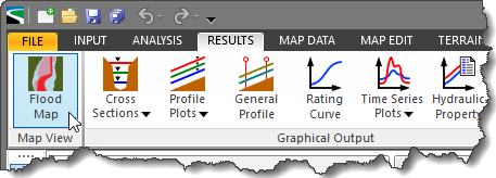
- From the Results ribbon menu, select the Flood Map command.

- The Flood Map dialog box will be displayed.
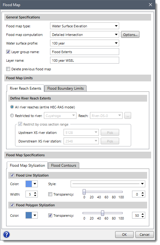
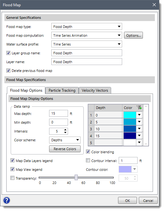
- In the Flood Map Specifications section, select the Flood Contours panel.
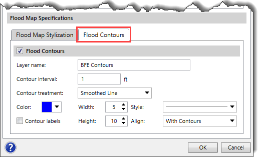
- Checking the Flood Contours checkbox option enables the following options under the Flood Contours panel:
- Layer name: This entry field is used to define the layer name to be created in the Map Data Layers panel for storing the flood contours. The default layer name is BFE Contours, which may be edited.
- Contour interval: This entry field is used to define the interval between the flood contour lines.
- Contour treatment: This dropdown entry is used to select the type of contour lines to be generated for the flood contours. The available options are Original Line, Smoothed Line, and Straight Line.
- Color: This color palette is used to select the color of the flood contour lines.
- Width: This spin control entry field is used to select the width of the flood contour lines.
- Style: This dropdown entry is used to select the style of the flood contour lines.
- Contour labels: Enabling this checkbox option displays the labels on the flood contour lines.
- Height: This spin control entry field is used to select the height of the labels on the flood contours.
- Align: This dropdown entry is used to select the alignment of the label with respect to the flood contour lines. The available entries are With Contours and Horizontal.
- After defining all the required data, click the [OK] button.
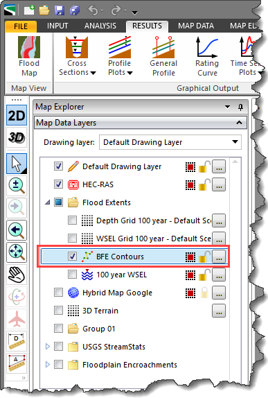
- The software will then generate the flood Map along with the flood contours for a 1D steady or unsteady project. In addition, the flood contours layer will also be created in the Map Data Layers panel.
Notes:
- For 1D steady projects, selecting 1D Steady Flow from the Flood map computation dropdown changes the content of the Flood Map dialog box. In addition, The Flood Contours panel will not be displayed in the Flood Map Specifications section.
- For 1D unsteady projects, selecting Time Series Animation from the Flood map computation dropdown changes the content of the Flood Map dialog box. In addition, The Flood Contours panel will not be displayed in the Flood Map Specifications section.
- For 1D Steady Flow and Time Series Animation flood map types, the flood contours can be generated similarly to the 2D unsteady projects as described in the below section.
Creating Flood Map Contours for 2D Unsteady Projects
Follow the steps below to create flood contours for 2D unsteady projects:
- From the Results ribbon menu, select the Flood Map command.
- The Flood Map dialog box will be displayed.
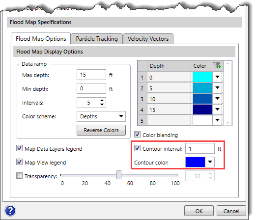
- In the Flood Map Specifications section, select the Flood Map Options panel.
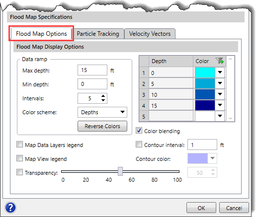
- Check the Contour interval checkbox option and define the intervals at which the flood contour lines should be displayed. The defined interval is used as a basis for generating contour lines that represent changes in the magnitude of flooding. The user can also select the color of the generated flood contours from the Contour color palette.
- After defining all the required data, click the [OK] button. The software will then generate the flood Map along with the flood contours for a 2D unsteady project.
Note that generating the flood contours for a 2D project using the above steps only displays the flood contours on the Map View and does not create any contour layer in the Map Data Layers panel, as shown below.
To create the contour layer in the Map Data Layers panel, follow the steps below:
- From the Flood Map dialog box, select the flood map type and other required options for generating a flood map.
- Then, click the [Options…] button adjacent to the Flood map computation dropdown combo box.
![Flood map computation [Options…] button](/wp-content/uploads/sites/25/2023/06/Flood-Map-Contours-Image-10.png)
- The Flood Map Computation Options dialog box corresponding to the selected flood map type will be displayed. The dialog box provides advanced options such as generating a flood elevation grid for the selected flood map type. Refer to this article in our knowledge base to learn how to generate an elevation data grid along with the flood map using the Flood Map Computation Options dialog box.
- After generating the flood elevation grid along with the flood map, the elevation grid layer will also be created in the Map Data Layers panel.
- The user can further utilize the generated flood elevation grid in the Generate Contours command to generate flood contours for 2D unsteady projects. Refer to this article in our knowledge base to learn how to use the flood elevation grid as the terrain surface to generate flood contours.
- After generating the flood contours, a flood contours layer will also be created in the Map Data Layers panel.
Exporting Flood Map Contours to CAD or Shapefile
The flood contours created for a 1D or 2D project can be further exported to CAD or a shapefile. To export flood contours, right-click on the flood contours layer created in the Map Data Layers panel and choose Export to CAD or Export to Shapefile from the displayed context menu.
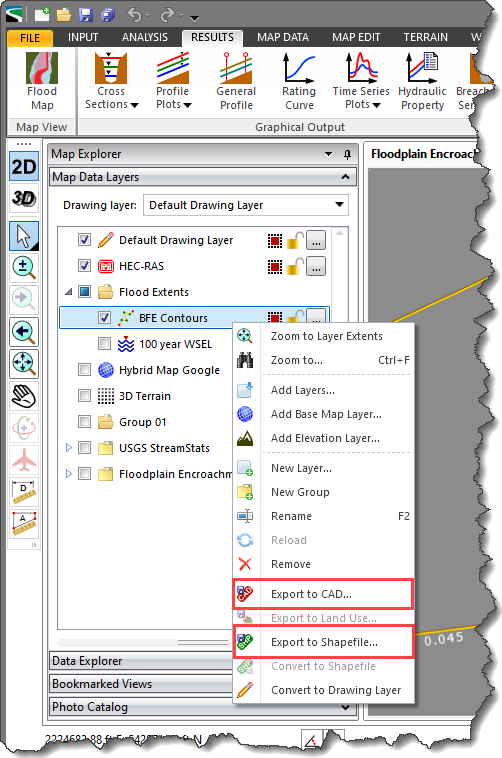
Refer to this article in our knowledge base to learn more about the Export to Shapefile command.
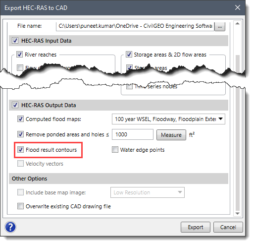
Alternatively, the user can export the entire project to CAD or a shapefile along with the flood map contours using the Export HEC-RAS to Shapefile or Export HEC-RAS to CAD command.
- Refer to this article in our knowledge base to learn more about the Export HEC-RAS to Shapefiles command.
- Refer to this article in our knowledge base to learn more about the Export HEC-RAS to CAD command.
Note: The Flood result contours option should be checked in the Export HEC-RAS to CAD and Export HEC-RAS to Shapefile dialog boxes for exporting the generated flood contours.