
Welcome to CivilGEO Knowledge Base
Welcome to CivilGEO Knowledge Base
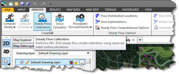
The Steady Flow Calibration command is used to perform HEC-RAS steady flow model calibration using observed water surface elevations. Using this command, the user can adjust the cross section Manning’s roughness to match an existing flood event so that the HEC-RAS model accurately predicts future floods.
Follow the steps below to use the Steady Flow Calibration command:
The following sections describe the Steady Flow Calibration command and how to interact with the above dialog box.
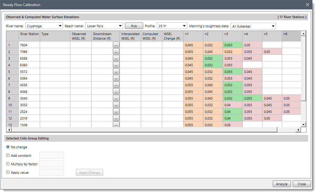
For an HEC‑RAS model with multiple river reaches, the user can select the desired river reach to perform the steady flow model calibration. The River name and Reach name dropdown combo boxes display a listing of the river and corresponding reaches contained within the model. The user can select the preferred river reach using these dropdown combo boxes.
Alternatively, click the [Pick] button adjacent to the Reach name entry to directly select a river reach from the Map View. On clicking the [Pick] button, the Steady Flow Calibration dialog box will temporarily disappear. The software will then prompt the user to select the river reach from the Map View. After selecting a river reach, the user will be returned to the dialog box with the river reach selected.
![[Pick] button](/wp-content/uploads/sites/25/2022/10/Steady-Flow-Calibration-Command-Image-3.png)
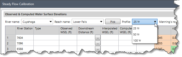
The Profile dropdown combo box displays a listing of all the computed water surface profiles contained within the selected model. The user can select the profile for which the HEC-RAS steady flow model calibration is to be performed.
The Manning’s Roughness Data dropdown combo box allows the user to select the cross section subareas on which the Manning’s adjustments are to be applied. The following options are provided in the dropdown combo box.
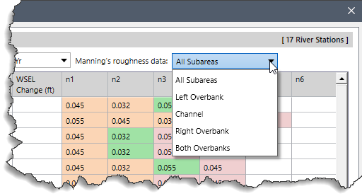
Based on the selected subareas, the data table will be updated and will show only those values that correspond to the selected subarea.
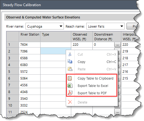
The data table in the Steady Flow Calibration dialog box lists the observed and computed water surface elevations and the roughness coefficients corresponding to the respective cross sections.
The data table displays the following data:
In addition, the data contained in the table can be copied to the clipboard or exported as a Microsoft Excel or PDF document. To do this, right-click on the table and select the Copy Table to Clipboard, Export Table to Excel, or Export Table to PDF command from the displayed context menu.
This section allows the user to select the type of adjustment to be performed on the selected river reach(es) and cross section subareas. The user can select the desired cells from the data table and then edit the cell’s coefficient either individually or in a batch.
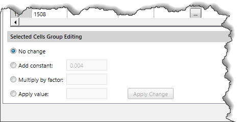
The user can edit the coefficients using:
To edit the cell’s coefficient, select the cell by clicking on it while pressing the [Ctrl] or [Shift] key; choose the desired cell-editing option; enter the change coefficient, and then click the [Apply Change] button. Note that the [Apply Change] button is only available when the group editing option other than the No Change option is selected and at least one cell is selected.
![[Apply Change] button](/wp-content/uploads/sites/25/2022/10/Steady-Flow-Calibration-Command-Image-8.png)
When all the options have been defined, click the [Analyze] button to perform the HEC-RAS steady flow model calibration. While the analysis is running, the button changes to [Cancel] so that the user can cancel the analysis if desired. When finished, the computed values will be shown in the Steady Flow Calibration data table. Click the [Close] button to close the dialog box.


CivilGEO G2 Reviews
4.8/5.0 Rating, Over 230 Reviews

GeoHECRAS is recognized as the top Civil Engineering Design Software with an average of 4.8 out of 5.0 rating from over 230 real user reviews on G2.


We use cookies to give you the best online experience. By agreeing you accept the use of cookies in accordance with our cookie policy.
When you visit any web site, it may store or retrieve information on your browser, mostly in the form of cookies. Control your personal Cookie Services here.


