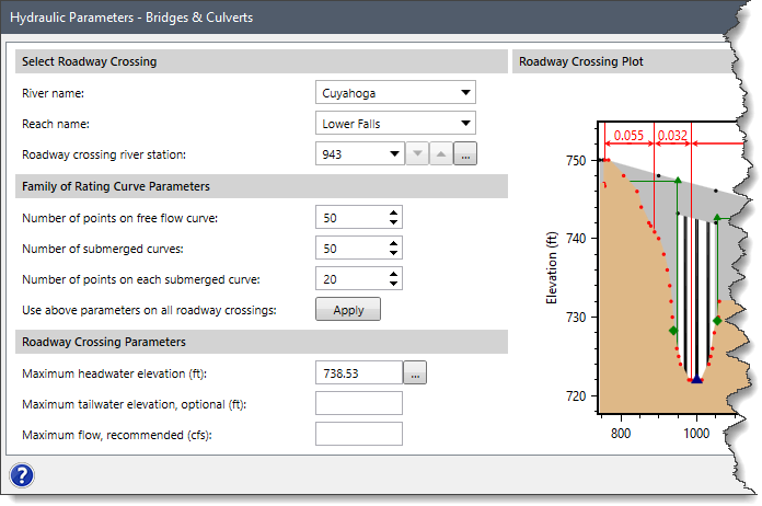
In GeoHECRAS, the Hydraulic Parameters – Bridges & Culverts command is used to define the hydraulic parameters that are used for building a family of rating curves for bridges and culverts. This data is only used for unsteady flow simulations and is ignored for steady flow simulations.
Follow the steps below to use the Hydraulic Parameters – Bridges & Culverts command:
- From the Analysis ribbon menu, click the Rating Curves – Hydraulic Parameters dropdown menu and select the Hydraulic Parameters – Bridges & Culverts command.
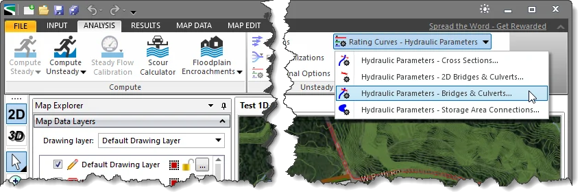
- The Hydraulic Parameters – Bridges & Culverts dialog box will be displayed.
The following sections describe the Hydraulic Parameters – Bridges & Culverts command and how to interact with the above dialog box.
Selecting Roadway Crossing
The Select Roadway Crossing section is used to select the roadway crossing for purposes of defining the hydraulic parameters.
This section covers the following options:
- River name
This read-only dropdown combo box lists all of the currently defined rivers. When the user selects a river, then the Reach name dropdown combo box also updates to show a valid corresponding river reach.
- Reach name
This read-only dropdown combo box lists all of the currently defined reaches that correspond to the selected river.
- Roadway crossing river station
This dropdown combo box lists the currently defined roadway crossing river stations that correspond to the selected reach. This field represents a unique value (lookup key) for the current river reach to identify a roadway crossing among other cross sections, roadway crossings, inline structures, and lateral structures. After the river station has been selected, the two cross sections that bound the bridge will be displayed on the Map View. In addition, the Up and Down arrow buttons are provided for moving to the next adjacent upstream and downstream roadway crossing within a river reach. Alternatively, the user can click the […] Pick button to graphically select the roadway crossing from the Map View.
Family of Rating Curve Parameters
The Family of Rating Curve Parameters section is used to define the limits of the family of rating curves that are developed for the roadway crossing.
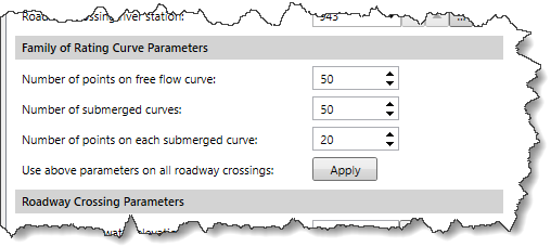
This section covers the following parameters:
- Number of points on free flow curve
This spin-control defines the number of points to be computed on the free flow curve. By default, the software uses a value of 50. However, the user can enter a different value ranging from 10 to 100.
- Number of submerged curves
This spin-control defines the number of submerged curves to be computed. By default, the software uses a value of 50. However, the user can enter a different value ranging from 10 to 100.
- Number of points on each submerged curve
This spin-control defines the number of points to be computed on each of the submerged curves. By default, the software uses a value of 20. However, the user can enter a different value ranging from 10 to 50.
- Use above parameters on all roadway crossings
Clicking the [Apply] button causes the above parameter values to be applied to all roadway crossings contained in the HEC-RAS current scenario.
Roadway Crossing Parameters
The Roadway Crossing Parameters section defines the parameters necessary to compute the rating curves for the selected roadway crossing:
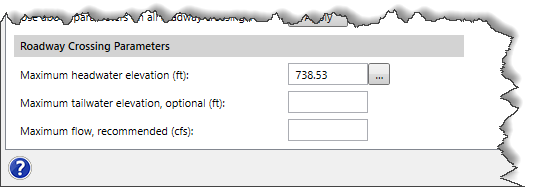
This section covers the following parameters:
- Maximum headwater elevation
This entry defines the maximum elevation that the water surface can reach on the upstream side of the roadway crossing. By default, this value is set to equal the maximum elevation for the roadway crossing high chord (weir geometry). Alternatively, the user can click the […] Pick button to graphically select the headwater elevation from the roadway crossing plot. Refer to this article in our knowledge base to learn more about setting the maximum headwater elevation parameter.
- Maximum tailwater elevation, optional
This optional entry defines the maximum elevation that the water surface can reach on the downstream side of the roadway crossing. By default, this entry is blank.
- Maximum flow, recommended
This optional (but recommended) entry defines the maximum flow expected at the roadway crossing. By default, this entry is blank.
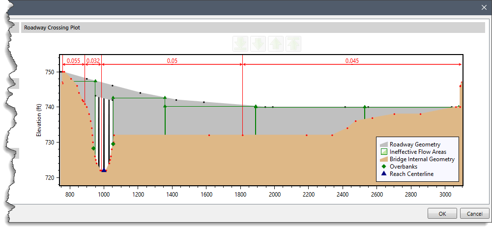
Roadway Crossing Plot
The Roadway Crossing Plot section displays the elevation versus horizontal station plot for upstream roadway cross sections.
After entering the appropriate information, the user can click the [OK] button to apply the defined changes and close the dialog box.


