
Welcome to CivilGEO Knowledge Base
Welcome to CivilGEO Knowledge Base
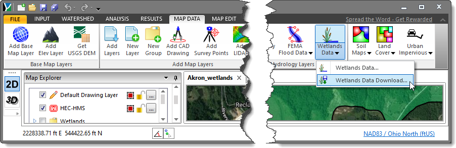
The Wetlands Data command of CivilGEO software allows the user to display the graphical representations of the type, size, and location of the wetlands, riparian, or related aquatic habitats in the United States from the US Fish and Wildlife Service. This command also allows the user to download the wetland and riparian data of the United States as shapefile data.
The U.S. Fish and Wildlife Service (hereafter Service) is the principal Federal agency that provides the citizens of the United States and its Trust Territories with current geospatially referenced information on the status, extent, characteristics, and functions of wetlands, riparian, deep water, and related aquatic habitats.
Note that this command works only within the United States.
Follow the steps given below to display the wetland, riparian, and related aquatic habitat data on the Map View:
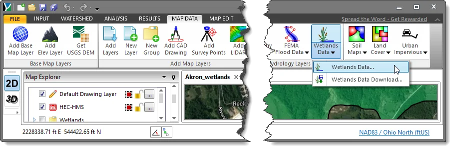
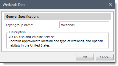
The following section describes how to interact with the above dialog box.
In this section, the user can specify the name of the wetlands layer in the Layer group name entry field. By default, the layer group name is “Wetlands”.
Clicking on the [OK] button will cause the software to display the wetland, riparian and related aquatic habitat data on the Map View.
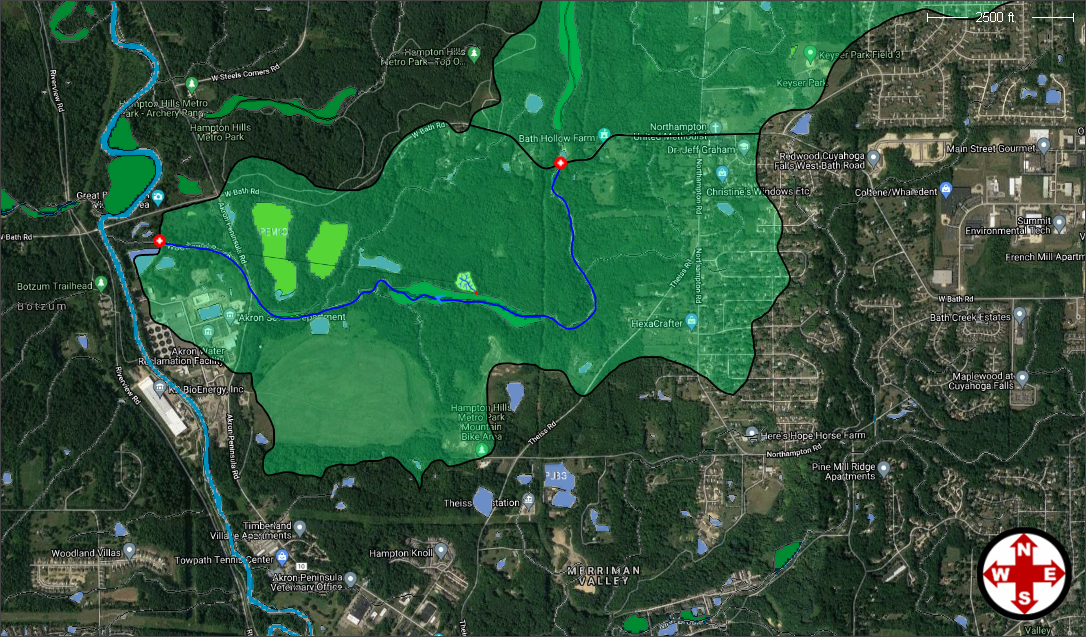
The software will then place the wetlands data in a layer group in the Map Data Layers panel.
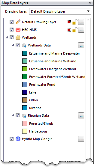
The Map Data Layers panel will contain a legend detailing the contents of the displayed wetlands data. The user can expand the layer to see the legend details.
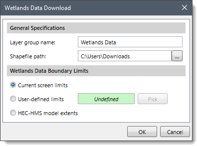
Follow the steps given below to download the wetland, riparian, and related aquatic habitat data as shapefile data:
The following sections describe how to interact with the above dialog box.
In this section, by default, the Layer group name is “Wetlands Data” which can be changed by the user. Click the […] button beside the Shapefile path entry to specify the directory location to save the downloaded shapefiles.
In this section, choose one of the three options for defining the geographic location:
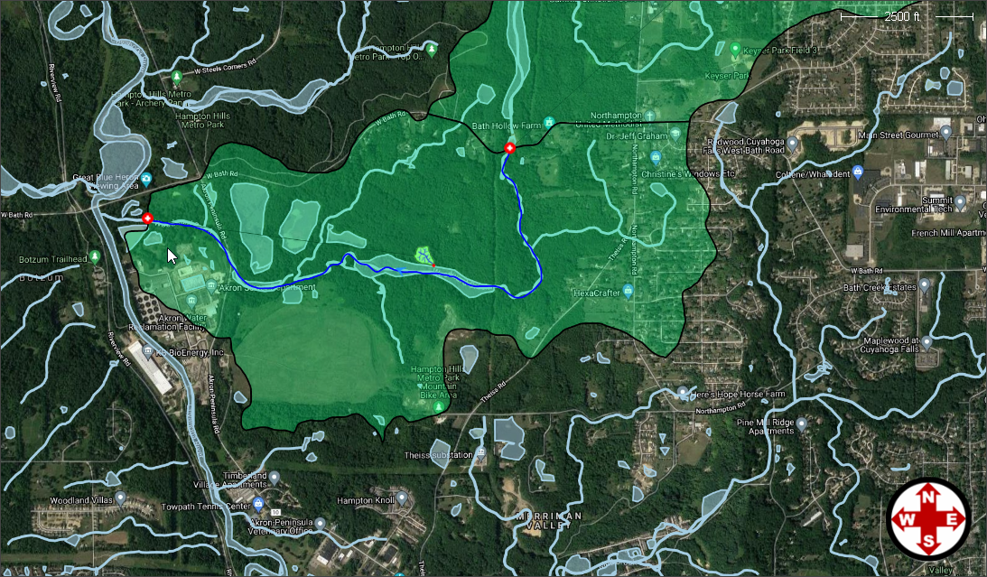
Clicking on the [OK] button will cause the software to download the wetlands, riparian and related aquatic habitat data as shapefile data. The software will also display the data on the Map View as shown below.
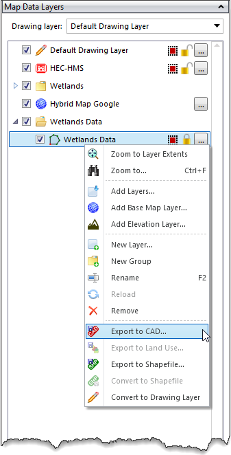
After the wetland map data has been downloaded, the software will then load the downloaded wetlands data in a new group in the Map Data Layers panel. Expand the group to see the details of the loaded layers. The user can also export the layers to CAD by right-clicking on a layer and then selecting the Export to CAD command from the displayed context menu.


CivilGEO G2 Reviews
4.8/5.0 Rating, Over 230 Reviews

GeoHECRAS is recognized as the top Civil Engineering Design Software with an average of 4.8 out of 5.0 rating from over 230 real user reviews on G2.


We use cookies to give you the best online experience. By agreeing you accept the use of cookies in accordance with our cookie policy.
When you visit any web site, it may store or retrieve information on your browser, mostly in the form of cookies. Control your personal Cookie Services here.


