
Welcome to CivilGEO Knowledge Base
Welcome to CivilGEO Knowledge Base
Survey points are a collection of elevation points with x-, y-, and associated z-values. These points generally represent a series of points showing the high and low extremes in the terrain that define topographic features such as streams, levees, ridges, and other phenomena.
The Add Survey Points command of CivilGEO software is used to add survey point data as a layer to the Map View. This command also allows the user to add new points to an existing point layer as well as filter out duplicate points.
Follow the steps below to use the Add Survey Points command:
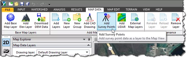
The following sections describe how to use the Add Survey Points command and interact with the above dialog box.
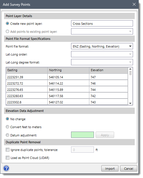
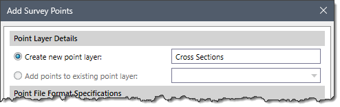
This section allows the user to create a new point layer in the Map Data Layers panel. New Points is the default point layer name, which can be changed by the user. The user can also add points to the existing point layer by using the Add points to existing point layer option. Note that the Add points to existing point layer option is only enabled when the user has already defined the point layer.
This section is used to define the specifications of the point file to be imported.
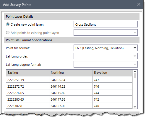
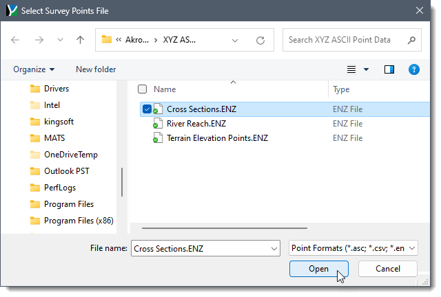
The Point file format dropdown combo box is used to select the file format into which the survey points data are to be imported. The file needs to be in an ASCII text file format, with either commas, tabs, or spaces delineating the data fields contained within each row of the survey points file.

The software will attempt to determine the selected survey points file format based on the file extension. However, the user can change the file format to be used after the file is selected.
For reference, Easting = X coordinate and Northing = Y coordinate.
The following survey points file formats are supported:
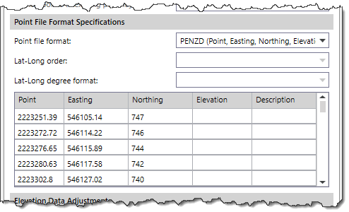
However, changing the file format also changes the column header(s) of the point file format table. For example, changing the file format from ENZ (Easting, Northing, Elevation) to PENZD (Point, Easting, Northing, Elevation, Description) will display the additional column header(s) in the table as shown below.
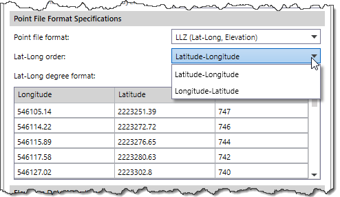
The Lat-Long order dropdown combo box is used to select the order of latitude (Lat) and longitude (Long) values into which the survey points data are to be imported.
Note that by default, this dropdown combo box is disabled. To enable this dropdown combo box, select one of the following options from the Point file format dropdown combo box:
The following options are available in the Lat-Long order dropdown combo box:
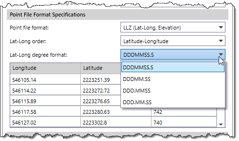
The Lat-Long degree format dropdown combo box is used to select the display format for latitude and longitude coordinates. It determines how degrees, minutes, and seconds will be displayed when working with geographical coordinates.
Note that by default, this dropdown combo box is disabled. To enable this dropdown combo box, select one of the following options from the Point file format dropdown combo box:
The following options are available in the Lat-Long degree format dropdown combo box:
This section allows the user to adjust the survey points data elevation values if the elevation data is in a different unit system or needs to have a datum adjustment.
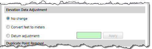 The user can select the desired elevation cells from the Point File Format Specifications data table and then edit the values using one of the following options:
In this section, the Ignore duplicate points, tolerance checkbox option is used to ignore/filter out the duplicate points from the survey file based upon the distance between points. The user can enter the desired distance/tolerance value (in feet) in the entry field next to this option by which the duplicate points are to be removed from the survey file. Alternatively, the user can check the Load as Point Cloud (LIDAR) checkbox option to import the survey points as a point cloud.
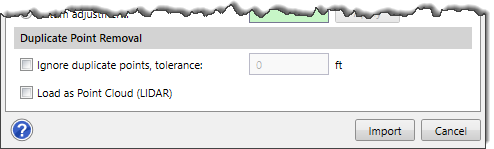
After specifying all the required importing details, click the [Import] button. The software will then add the survey points to the Map View and load the point file as a new group in the Map Data Layers panel.


CivilGEO G2 Reviews
4.8/5.0 Rating, Over 230 Reviews

GeoHECRAS is recognized as the top Civil Engineering Design Software with an average of 4.8 out of 5.0 rating from over 230 real user reviews on G2.


We use cookies to give you the best online experience. By agreeing you accept the use of cookies in accordance with our cookie policy.
When you visit any web site, it may store or retrieve information on your browser, mostly in the form of cookies. Control your personal Cookie Services here.


