
Welcome to CivilGEO Knowledge Base
Welcome to CivilGEO Knowledge Base
Ineffective flow areas can be assigned to the 2D mesh to account for regions where the water is not actively being conveyed. The water will pond in such areas, and its velocity in the downstream direction will be close to zero. This water is included in the storage calculations, but it is not included as part of the active flow area. When using ineffective flow areas, no wetted perimeter friction is included at the boundary between the ineffective flow area and active flow area.
2D ineffective flow areas are assigned using polygons. The software will automatically refine the 2D mesh to accommodate the ineffective flow area shape.

If polygons have already been drawn on the Map View or a polygon shapefile layer has been loaded to represent ineffective flow areas, then the Assign 2D Ineffective Flow Areas command can be used to assign 2D ineffective flow areas.
Follow the steps below to use the Assign 2D Ineffective Flow Areas command:
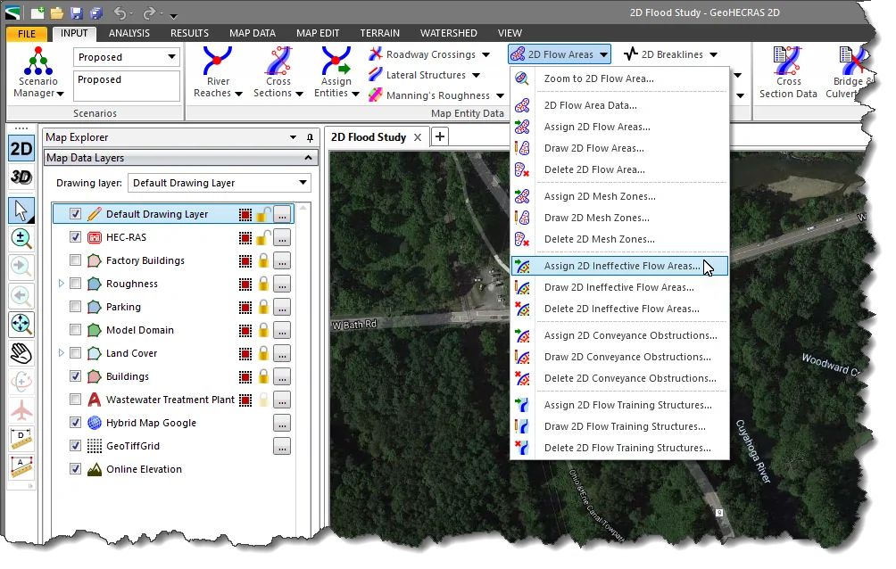
The following sections describe how to use these assignment options.
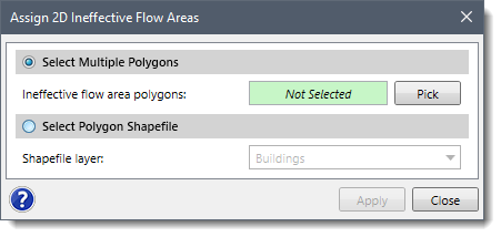
This option allows multiple polygons to be interactively selected from the Map View and then assigned as ineffective flow areas.
Follow the steps below to assign ineffective flow areas using the Select Multiple Polygons option:
![[Pick] button - Assign 2D Ineffective Flow Areas dialog box](/wp-content/uploads/sites/25/2018/08/2D-Ineffective-Flow-Areas-image-5.png)
![[Apply] button - Assign 2D Ineffective Flow Areas dialog box](/wp-content/uploads/sites/25/2018/08/2D-Ineffective-Flow-Areas-image-6.png)
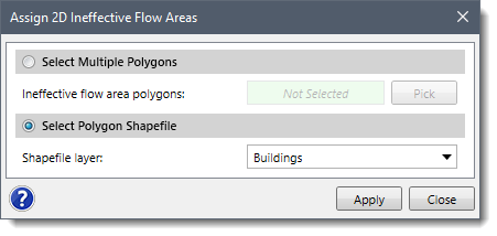
This option allows a polygon shapefile layer to be used to assign 2D ineffective flow areas.
Follow the steps below to assign ineffective flow areas using the Select Polygon Shapefile option:
![[Apply] button](/wp-content/uploads/sites/25/2018/08/2D-Ineffective-Flow-Areas-image-8.png)
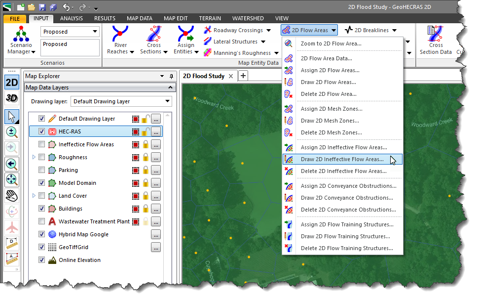
The user can interactively draw polygons on the Map View in order to define the ineffective flow areas.
Follow the steps below to use the Draw 2D Ineffective Flow Areas command:

![[Apply] button - Draw Ineffective Flow Areas dialog box](https://knowledge.www.civilgeo.com/wp-content/uploads/sites/25/2018/08/2D-Ineffective-Flow-Areas-Imge-11.png)
After the ineffective flow area polygons have been defined, the software will stamp them into the 2D mesh flow area and refine the mesh to account for each polygon’s shape.
Follow the steps below to incorporate ineffective flow areas into the 2D Mesh:
![[Update] button - 2D Flow Area Data dialog box](/wp-content/uploads/sites/25/2018/08/2D-Ineffective-Flow-Areas-image-12.png)


CivilGEO G2 Reviews
4.8/5.0 Rating, Over 230 Reviews

GeoHECRAS is recognized as the top Civil Engineering Design Software with an average of 4.8 out of 5.0 rating from over 230 real user reviews on G2.


We use cookies to give you the best online experience. By agreeing you accept the use of cookies in accordance with our cookie policy.
When you visit any web site, it may store or retrieve information on your browser, mostly in the form of cookies. Control your personal Cookie Services here.


