
Welcome to CivilGEO Knowledge Base
Welcome to CivilGEO Knowledge Base
HEC‑RAS allows the user to define levees to constrain the flow to the main channel by defining a left and/or right levee station and corresponding elevation at a cross section.
Levee locations must be defined explicitly or HEC‑RAS assumes that water can go anywhere within the cross section.
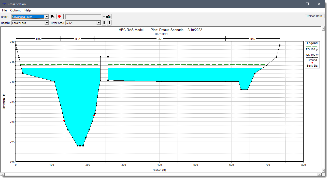
When levees are defined, water cannot go left of the left levee station or right of the right levee station until the corresponding levee elevation is exceeded.
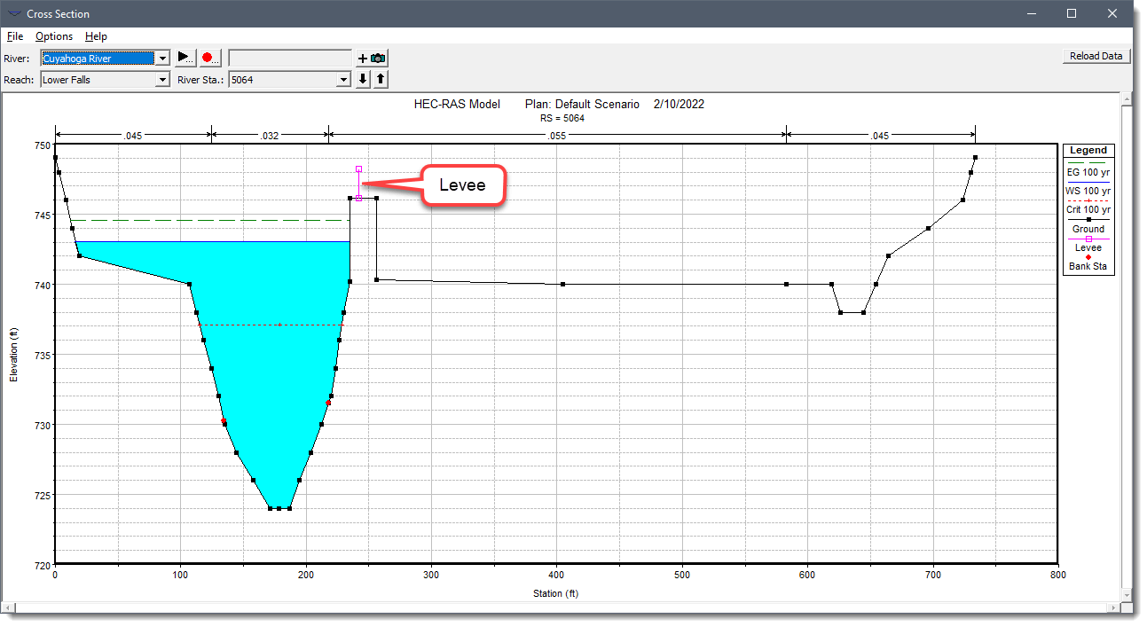
The user may want to add levees to a cross section in order to see what effect a levee will have on the water surface. A simple way to do this is to set a levee station and elevation that is above the existing ground. If a levee elevation is placed above the existing geometry of the cross section, then a vertical wall is placed at that station up to the defined levee elevation.
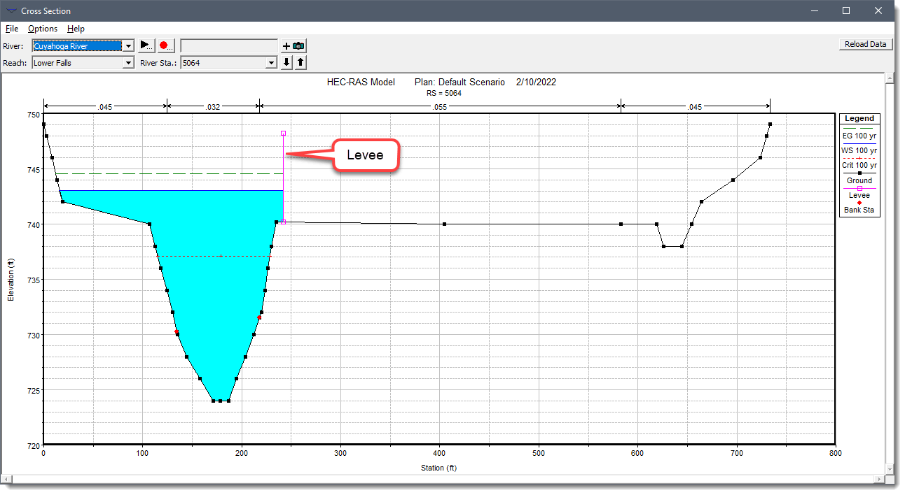
Additional wetted perimeter is included when water comes into contact with the levee wall.
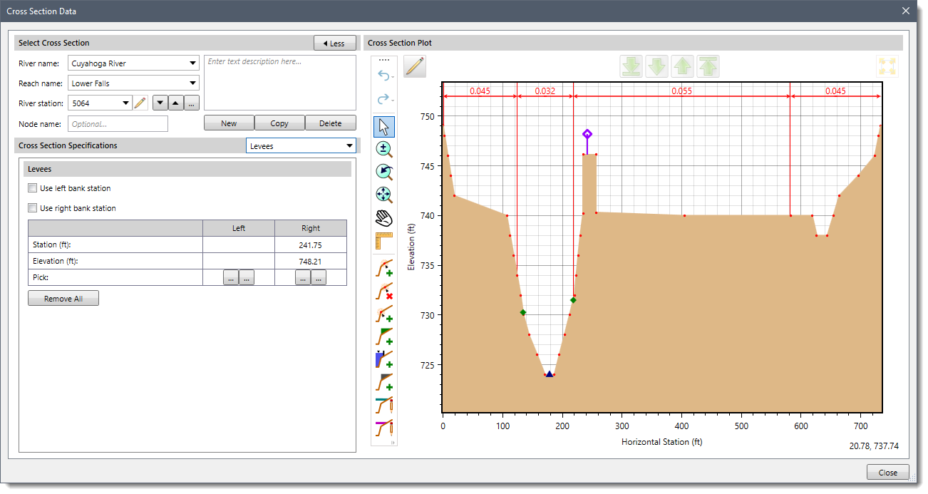
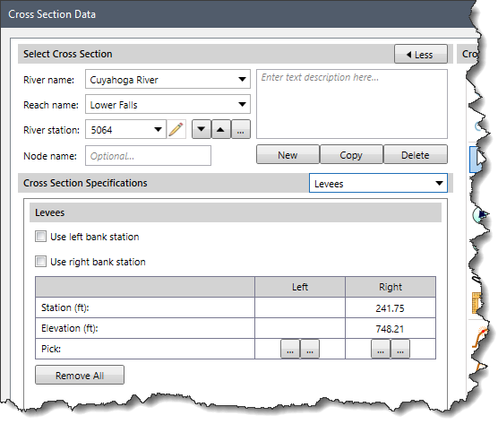
The user can use the Cross Section Data dialog box to manually define the levees by selecting horizontal stations and elevations for each of the levees. The user can select the horizontal stations from either the Map View or from the displayed cross section plot.
Levees are defined in the Cross Section Data dialog box, in the Levees panel.
Alternatively, the user can specify that the left and/or right bank stations should act as levees. In that way, water is contained within the channel.
As another option, the user can utilize GIS polylines to define levees. From the Input ribbon menu, select the Assign Entities menu item and then choose the Assign Levees command. This will display the Assign Levees dialog box.
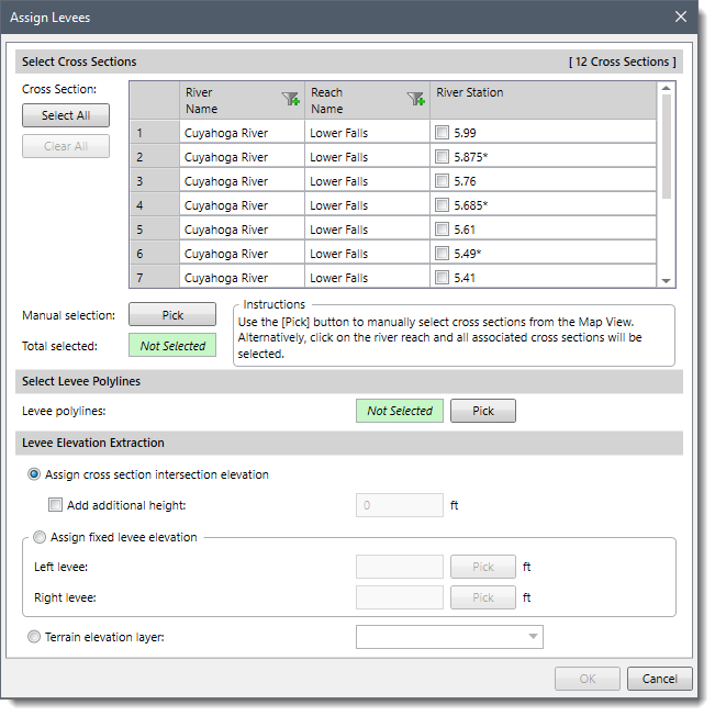
From this dialog box, the user can select GIS polylines to define the levees.


CivilGEO G2 Reviews
4.8/5.0 Rating, Over 230 Reviews

GeoHECRAS is recognized as the top Civil Engineering Design Software with an average of 4.8 out of 5.0 rating from over 230 real user reviews on G2.


We use cookies to give you the best online experience. By agreeing you accept the use of cookies in accordance with our cookie policy.
When you visit any web site, it may store or retrieve information on your browser, mostly in the form of cookies. Control your personal Cookie Services here.


