
Welcome to CivilGEO Knowledge Base
Welcome to CivilGEO Knowledge Base
The Standard Project Storm precipitation type of the Meteorology Data dialog box provides precipitation versus time relationship that is designed to be reasonably representative of major storms that have occurred or might occur in the area of concern. It is developed by studying the major storm events in the region, excluding the most extreme.
When Standard Project Storm is selected as the Precipitation type in the Meteorology Data dialog box, the following data panel will be displayed for the Precipitation Data selector.
The following sections describe how to interact with the Standard Project Storm data panel of the Meteorology Data dialog box.
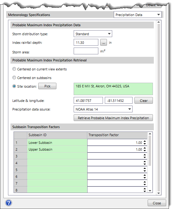
This section of the data panel includes the following input parameters:
This section of the data panel includes the following options.
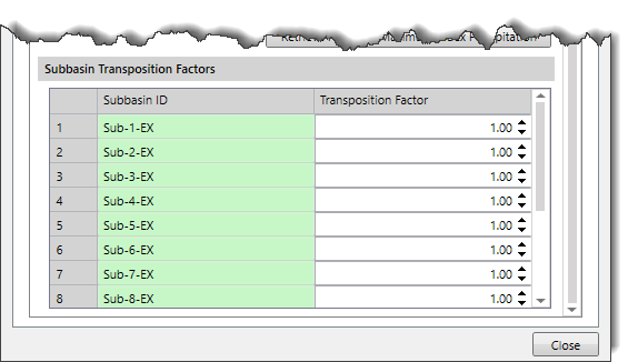
The data grid of this section has two columns. The Subbasin ID column lists all the subbasins contained within the scenario, and the Transposition Factor column accounts for the location of each subbasin contained in the scenario, relative to the center of the storm.


CivilGEO G2 Reviews
4.8/5.0 Rating, Over 230 Reviews

GeoHECRAS is recognized as the top Civil Engineering Design Software with an average of 4.8 out of 5.0 rating from over 230 real user reviews on G2.


We use cookies to give you the best online experience. By agreeing you accept the use of cookies in accordance with our cookie policy.
When you visit any web site, it may store or retrieve information on your browser, mostly in the form of cookies. Control your personal Cookie Services here.


