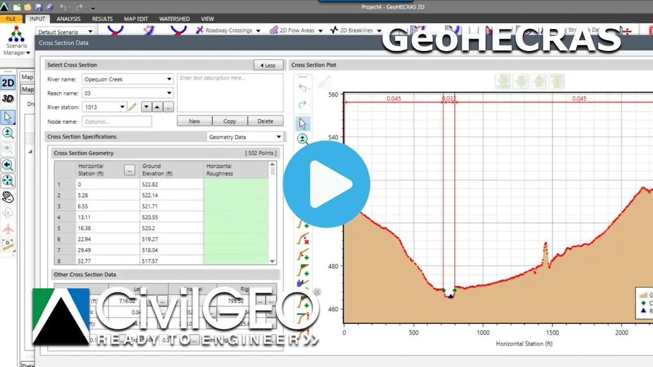
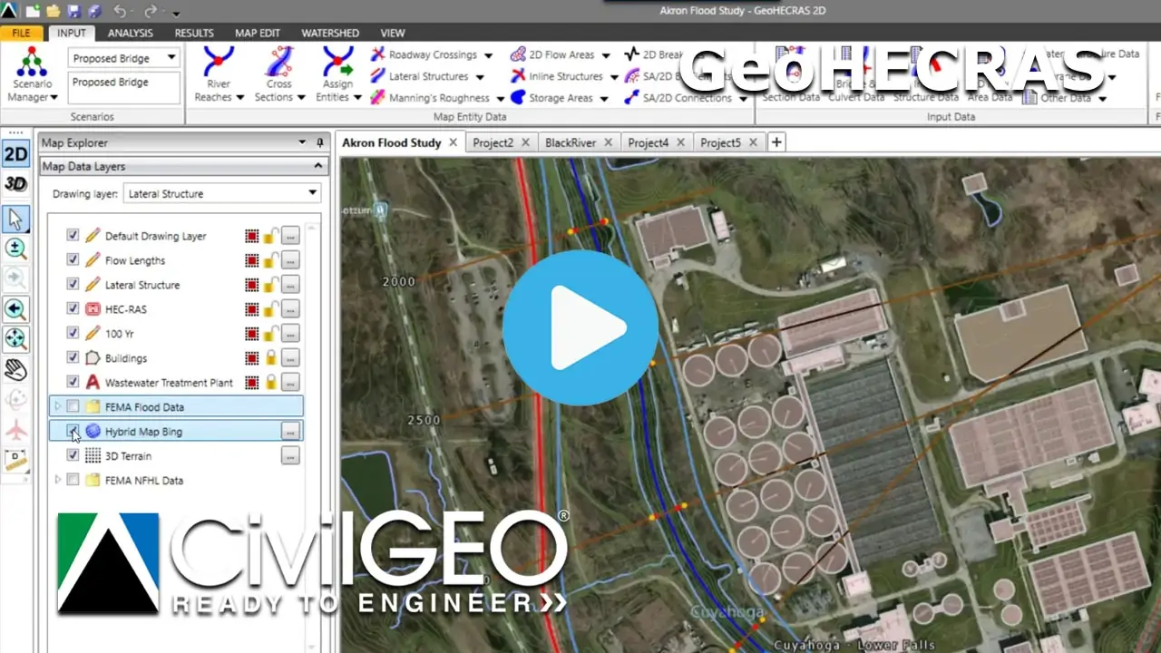
All Videos
Bridge Modeling with HEC-RAS
25m 16s
Draw 2D Patch Faces command
03m 37s
Georeferencing a HEC-RAS Model to a River Alignment
12m 17s
Scenario Management with
HEC-RAS
HEC-RAS
04m 55s
Georeferencing a HEC-RAS Model to Map
05m 05s
Incorporating a HEC-RAS model into Google Earth
01m 26s
Automating Floodplain Encroachment Modeling with
HEC-RAS
HEC-RAS
14m 45s
Exporting a Flood Model to
HEC-RAS
HEC-RAS
02m 31s
Exporting a HEC-RAS model to AutoCAD
02m 15s
3D Flyby Animation of a HEC-RAS Model
02m 08s
Displaying FEMA Flood Map Data on a HEC-RAS Model
02m 35s
ESRI TIN to Elevation Raster Conversion
25m 09s
Adding a GIS Shapefile to a
HEC-RAS Model
HEC-RAS Model
02m 41s
Adding a Base Map Layer in
HEC-RAS
HEC-RAS
03m 19s
Adding and Georeferencing an AutoCAD Drawing to a HEC-RAS Model
03m 17s
GeoHECRAS Training Course – Session 01
1h 25m 38s
GeoHECRAS Training Course – Session 02
06m 01s
GeoHECRAS Training Course – Session 03
19m 22s
GeoHECRAS Training Course – Session 04
11m 52s
GeoHECRAS Training Course – Session 05
08m 10s
GeoHECRAS Training Course – Session 06
11m 49s
GeoHECRAS Training Course – Session 07
06m 35s
GeoHECRAS Training Course – Session 08
15m 45s
GeoHECRAS Training Course – Session 09
55m 41s
GeoHECRAS Training Course – Session 10
44m 57s
GeoHECRAS Training Course – Session 11
58m 19s
GeoHECRAS Training Course – Session 12
39m 57s
GeoHECRAS Training Course – Session 13
02m 56s
GeoHECHMS Training Course – Session 01
1h 02m 09s
Workflow Training
GeoHECRAS Training
GeoHECHMS Training
Awards & Recognition