The Soil Conservation Service (SCS) unit hydrograph method defines a curvilinear unit hydrograph by setting the percentage of the unit runoff that occurs before the peak flow. The unit hydrograph impacts the shape of the runoff hydrograph generated by the model, particularly the peak rate of discharge.
The standard unit hydrograph is defined as 37.5% of the unit runoff occurring before the peak flow. This definition corresponds to a peak rate factor (PRF) of 484, which incorporates the percentage of unit runoff before the peak.
However, the percentage of unit runoff occurring before the peak flow is not uniform across all watersheds, as it depends on flow length, ground slope, and other watershed properties.
For stormwater projects, the user can follow the steps below to select a hydrograph peak rate factor:
- Under the File ribbon menu, select the Options backstage page.
- The Options backstage page will be displayed. From either the Project Options or Application Options, click the SCS hydrograph peaking factor dropdown combo box under the General Preference section.
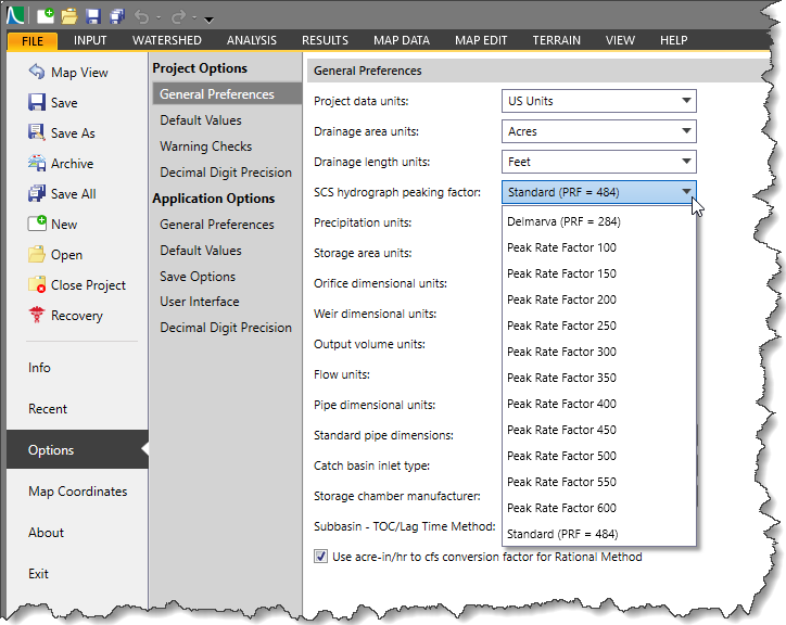
The SCS hydrograph peaking factor option allows the user to select the peaking factor, which controls the runoff on the rising and recession limbs of the hydrograph. By default, the Standard (PRF = 484) option is selected. The user can pick any other peak rate factor value, and the software will automatically construct the unit hydrograph and display it as a graphical plot in the Subbasin Data dialog box or Plot Hydrographs dialog box.
The following graphical representation shows a comparison between two dimensionless unit hydrographs with different peak rate factor values. 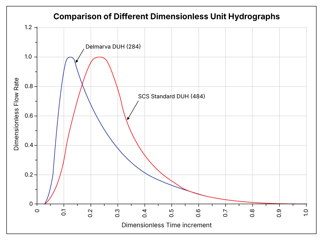
The following table describes the typical hydrograph peaking factors available in CivilGEO Software:
| Unit Hydrograph | Peaking Factor | Typical Applications |
|---|---|---|
| Delmarva | 284 | Applies to Atlantic coastal plain watersheds, characterized by flat topography (average watershed slope less than 5%) |
| Standard | 484 | The default and standard SCS dimensionless unit hydrograph used nationwide by TR-20 and TR-55. |
| Peak Rate Factor 100 to Peak Rate Factor 600 | 100-600 | These PRF values are commonly used where a site-specific unit hydrograph table is not available. |
Note that flat watersheds typically have a lower PRF that may be as small as 100. In contrast, steeper watersheds have a larger PRF that may range up to 600.
The following table provides a description of typical hydrograph peaking factors along with their limb ratios (ratio of the recession limb length to rising limb length):
| Peaking Factor | Limb Ratio (Recession to Rising) | Description |
|---|---|---|
| 575 | 1.25 | Urban areas, steep slopes |
| 484 | 1.67 | Typical SCS |
| 400 | 2.25 | Mixed urban/rural |
| 300 | 3.33 | Rural, rolling hills |
| 200 | 5.50 | Rural, slight slopes |
| 100 | 12.0 | Rural, very flat |