
Welcome to CivilGEO Knowledge Base
Welcome to CivilGEO Knowledge Base
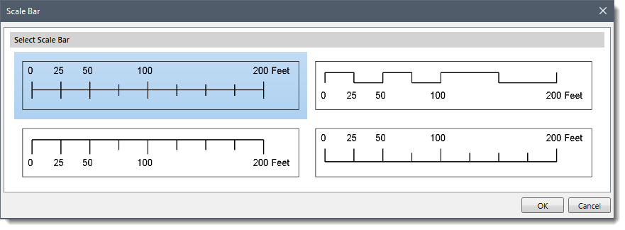
Scale bars provide a visual indication of distance and feature size on the map. A scale bar is a line or bar divided into parts. It is labeled with its ground length, usually in multiples of map units, such as tens of kilometers or hundreds of miles. Scale bars are associated with a map frame in a layout. If the map scale for that map frame changes, the scale bar updates to maintain consistency.
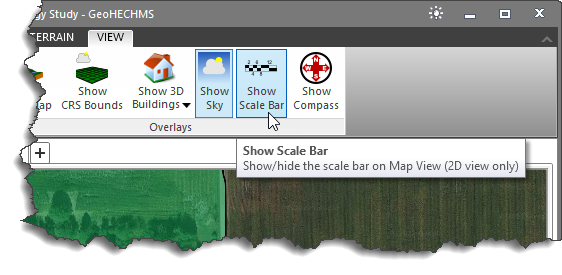
The Show Scale Bar command of CivilGEO’s software allows the user to show/hide a scale bar on the Map View (2D View Mode only).
To enable a scale bar on the Map View, select the Show Scale Bar command from the View ribbon menu.
The Scale Bar dialog box will be displayed. Select the desired scale bar type and click the [OK] button to apply it to the Map View.
The selected scale bar will appear on the Map View.
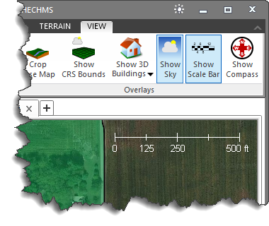
Note that if the scale bar has already been applied to the Map View, selecting the Show Scale Bar command hides the scale bar from the Map View.


CivilGEO G2 Reviews
4.8/5.0 Rating, Over 230 Reviews

GeoHECRAS is recognized as the top Civil Engineering Design Software with an average of 4.8 out of 5.0 rating from over 230 real user reviews on G2.


We use cookies to give you the best online experience. By agreeing you accept the use of cookies in accordance with our cookie policy.
When you visit any web site, it may store or retrieve information on your browser, mostly in the form of cookies. Control your personal Cookie Services here.


