
Welcome to CivilGEO Knowledge Base
Welcome to CivilGEO Knowledge Base
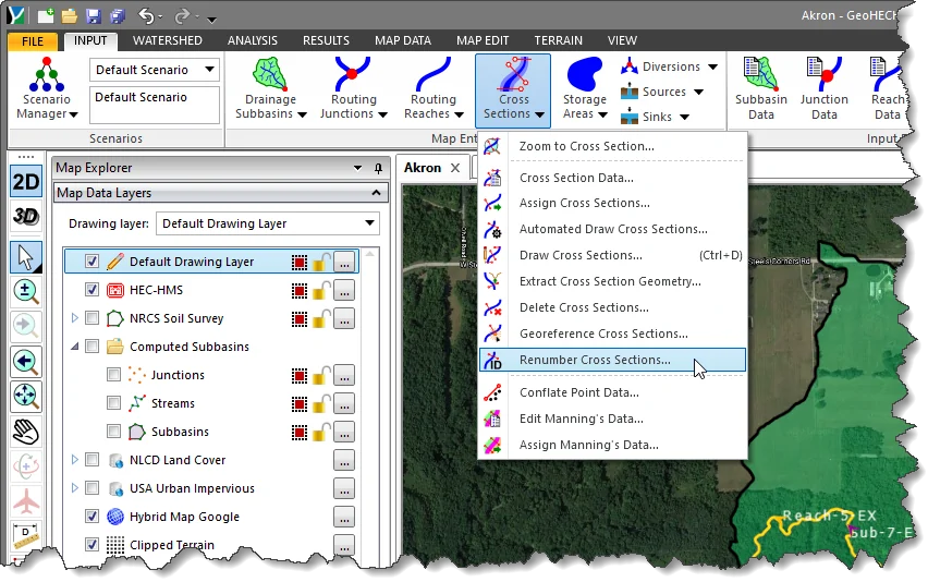
The Renumber Cross Sections command allows the user to automatically renumber cross sections, reaches, and junctions along a defined flow path.
Follow the steps below to use the Renumber Cross Sections command:
The following sections describe the Renumber Cross Sections command and how to interact with the above dialog box.
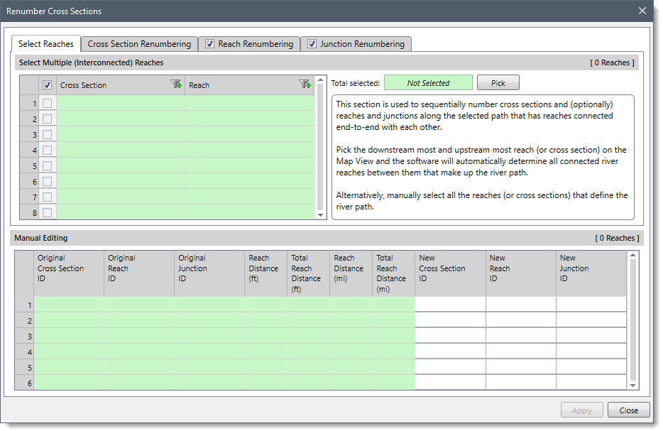
The Select Reaches panel is used to select all the reaches (or cross sections) that define the river path.
The Select Multiple (Interconnected) Reaches section is used to manually select the reaches (or cross sections) that make up a river path. If a reach (or cross section) is already selected on the Map View prior to running this command, the same reach (or cross section) will be shown selected within the table.
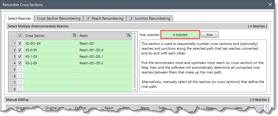
Alternatively, the user can click the [Pick] button to select the reaches (or cross sections) from the Map View. On clicking the [Pick] button, the Renumber Cross Sections dialog box will temporarily disappear, and a prompt will be displayed on the status bar instructing the user to select the reaches (or cross sections) from the Map View. After selecting the reaches (or cross sections), the user can press the [Enter] key or right-click and choose Done from the displayed context menu. The Renumber Cross Sections dialog box will be redisplayed, and the total number of selected reaches (or cross sections) will be displayed in the Total selected read-only field.
Notes:
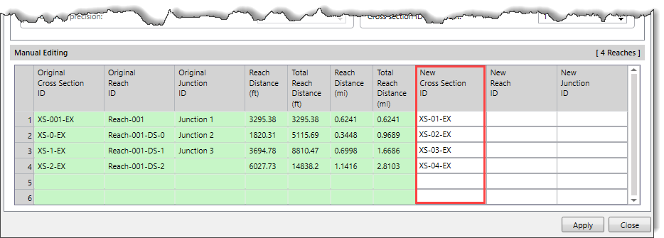
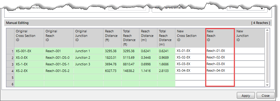
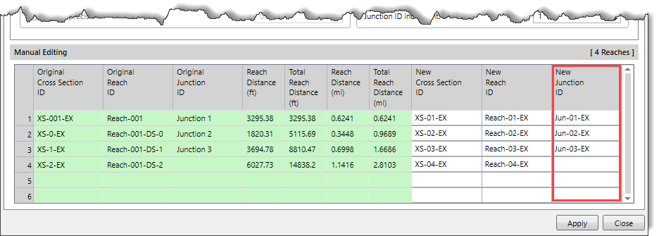
This section contains a data grid listing all IDs of the selected cross sections, reaches, and junctions. The data grid also lists the reach distance and total reach distance in miles and feet. The values in the last three columns of the data grid provides a preview of the cross sections, reaches, and junctions naming specifications defined in the Cross Section Renumbering, Reach Renumbering, and Junction Renumbering panels.
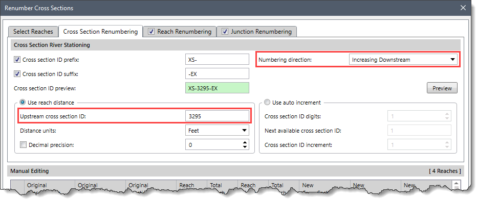
This panel allows the user to number the cross sections based upon river chainage or incrementally.
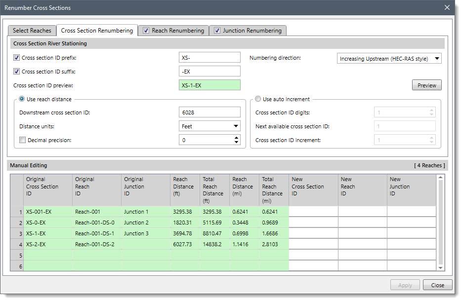
This section is used to define the river stationing to be used for the constructed cross sections. Cross sections can be numbered using a fixed increment or by the river chainage along the river reach. The river chainage can be in miles or feet if working in US units, or kilometers or meters if working in metric (SI) units.
The following options are provided in the data panel:
The Use reach distance subsection is used to number the cross section by using the river chainage along the river reach. The following entries are provided:
The Use auto increment subsection is used to number the cross section using a fixed increment. The following options are provided.
Clicking on the [Preview] button causes the software to fill the cross section IDs in the New Cross Section ID column of the Manual Editing data grid.
This panel allows the user to number the reaches based upon river chainage or incrementally. By default, the Reach Renumbering checkbox panel is checked. If the panel checkbox is unchecked, then the content of this panel will be disabled and the reach will not be renumbered.
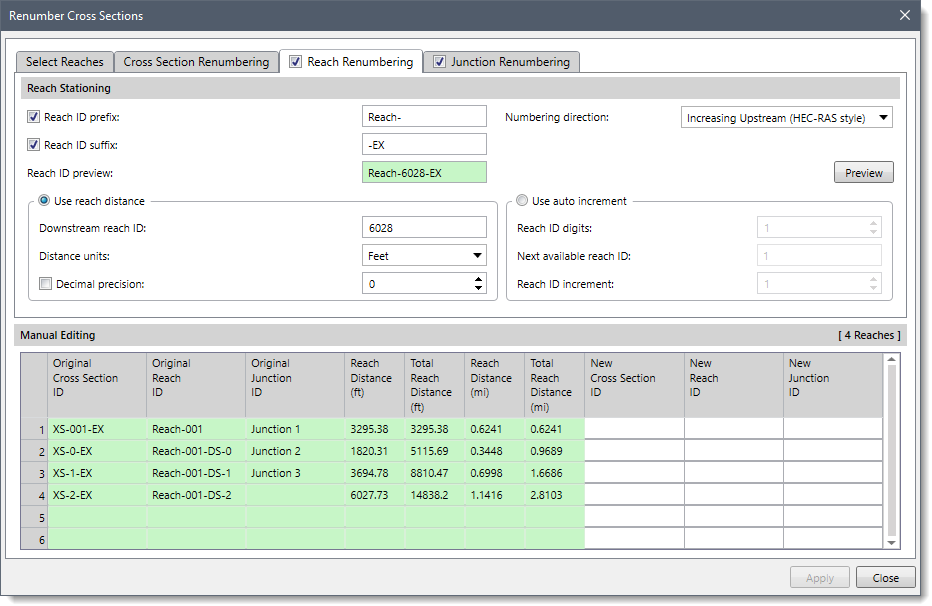
This section is used to define the river stationing to be used for the constructed reaches.
The following options are provided in the data panel:
This subsection is similar to that of the Use reach distance subsection of the Cross Sections Renumbering panel. Hence, refer to the first subsection of the Cross Sections Renumbering panel to learn more about it.
The Use auto increment subsection is used to number the reach using a fixed increment. The following options are provided.
Clicking on the [Preview] button causes the software to fill the reach IDs in the New Reach ID column of the Manual Editing data grid.
This panel allows the user to number the junctions based upon river chainage or incrementally. By default, the Junction Renumbering checkbox panel is checked. If the panel checkbox is unchecked, then the content of this panel will be disabled and the junction will not be renumbered.
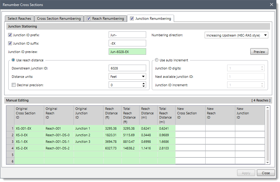
This section is used to define the river stationing to be used for the constructed junctions.
The following options are provided in the data panel:
This subsection is similar to that of the Use reach distance subsection of the Cross Sections Renumbering panel. Hence, refer to the first subsection of the Cross Sections Renumbering panel to learn more about it.
The Use auto increment subsection is used to number the junction using a fixed increment. The following options are provided:
Clicking on the [Preview] button causes the software to fill the junction IDs in the New Junction ID column of the Manual Editing data grid.
When the data has been defined in the Renumber Cross Sections dialog box, click the [Apply] button.
![[Apply] button](/wp-content/uploads/sites/25/2022/09/Renumber-Cross-Sections-Command-Image-11.png)
The software will then renumber the IDs of the cross sections, reaches, and junctions along a defined flow path.


CivilGEO G2 Reviews
4.8/5.0 Rating, Over 230 Reviews

GeoHECRAS is recognized as the top Civil Engineering Design Software with an average of 4.8 out of 5.0 rating from over 230 real user reviews on G2.


We use cookies to give you the best online experience. By agreeing you accept the use of cookies in accordance with our cookie policy.
When you visit any web site, it may store or retrieve information on your browser, mostly in the form of cookies. Control your personal Cookie Services here.


