
Welcome to CivilGEO Knowledge Base
Welcome to CivilGEO Knowledge Base
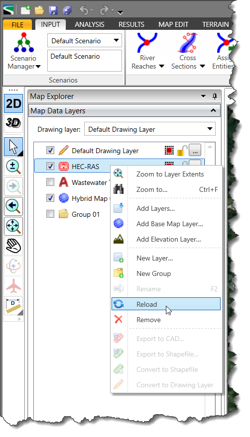
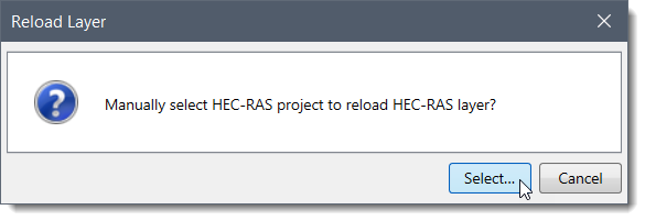
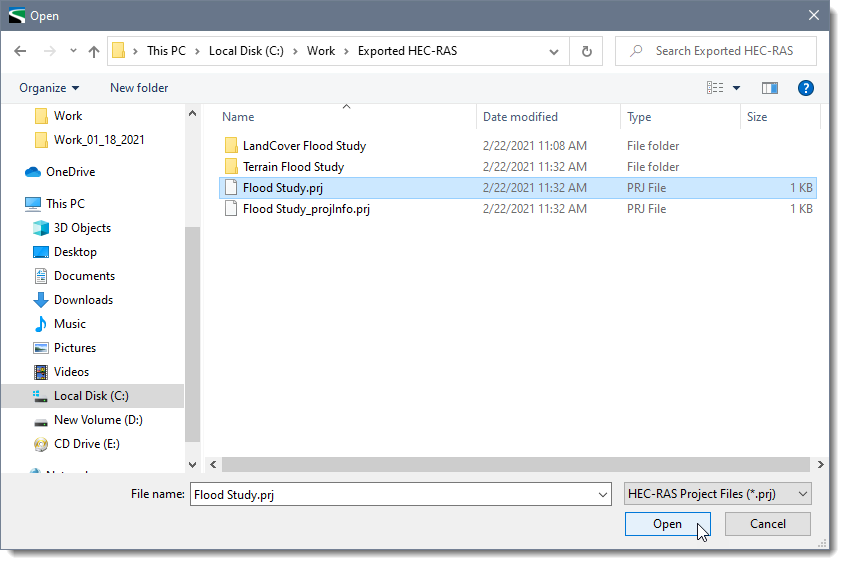
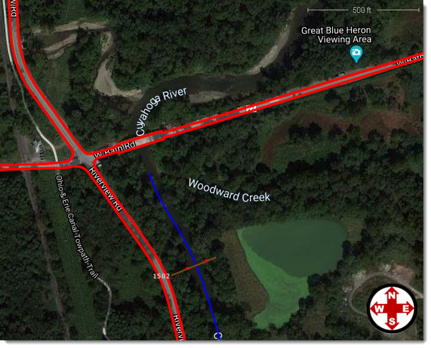
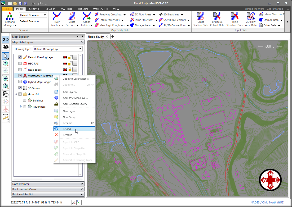
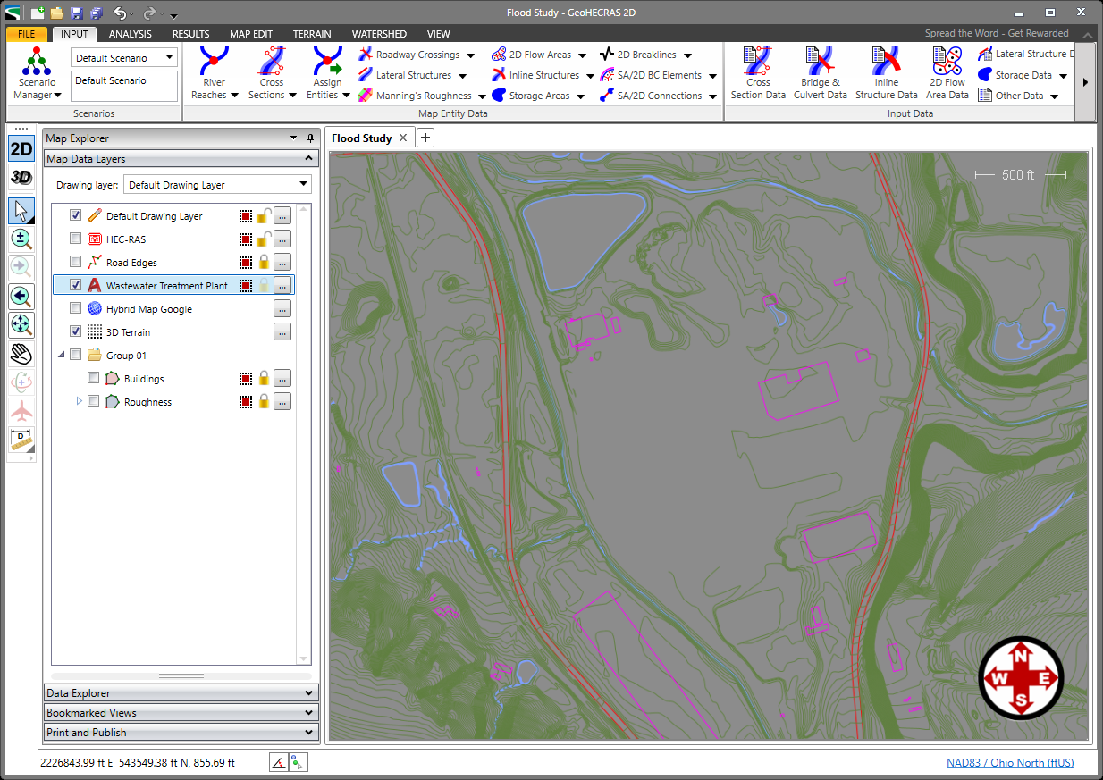
CivilGEO software allows the user to reload a layer by right-clicking on the layer and selecting the Reload Layer command. For example, to reload an external AutoCAD drawing that has just been modified, use the Reload Layer command. This prevents the user from having to unload the drawing and then reopen the new drawing. Similarly, if you have made changes to the HEC‑RAS model outside of GeoHECRAS using the US Army Corps HEC‑RAS software, then reloading the HEC‑RAS model will cause those changes to be reflected in the HEC‑RAS model contained within GeoHECRAS.
Similarly, if the user has made modifications to the HEC-HMS model outside of the GeoHECHMS application using the US Army Corps HEC-HMS software, then reloading the HEC‑HMS model will cause those changes to be reflected in the HEC‑HMS model contained within GeoHECHMS.
Note that any modified layer options, such as AutoCAD layer visibility, color changes, assigned coordinate reference system, and other options are retained for the newly reloaded layer.
Follow these steps to see the before and after changes while reloading a modified layer:
The CivilGEO software also allows the user to reload a modified external AutoCAD drawing file.
Follow the steps below to reload a modified AutoCAD drawing file:


CivilGEO G2 Reviews
4.8/5.0 Rating, Over 230 Reviews

GeoHECRAS is recognized as the top Civil Engineering Design Software with an average of 4.8 out of 5.0 rating from over 230 real user reviews on G2.


We use cookies to give you the best online experience. By agreeing you accept the use of cookies in accordance with our cookie policy.
When you visit any web site, it may store or retrieve information on your browser, mostly in the form of cookies. Control your personal Cookie Services here.


