
Welcome to CivilGEO Knowledge Base
Welcome to CivilGEO Knowledge Base
The Recompute Properties command of GeoHECHMS is used to compute the hydrologic properties (attributes) of HEC-HMS elements (subbasin polygons and reach polylines). Refer to this article in our knowledge base to learn more about hydrologic properties.
Note that if the user has not delineated the subbasins using the Delineate Subbasins command before running this command, the software will prompt the user to perform those computations. Hydrologic properties of only those HEC-HMS elements delineated using the Delineate Subbasins command are computed. To learn more about the Delineate Subbasins command, refer to this article in our knowledge base.
Follow the steps below to use the Recompute Properties command:
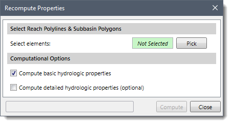
![[Pick] Button](/wp-content/uploads/sites/25/2022/01/Recompute-Properties-Command-Image-3.png)
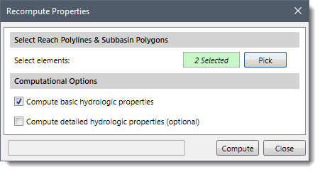
![[Compute] Button](/wp-content/uploads/sites/25/2022/01/Recompute-Properties-Command-Image-5.png)
Note that if the user has selected polylines and polygons that do not have the necessary data fields for storing the hydrologic properties, the command will skip over those elements.


CivilGEO G2 Reviews
4.8/5.0 Rating, Over 230 Reviews

GeoHECRAS is recognized as the top Civil Engineering Design Software with an average of 4.8 out of 5.0 rating from over 230 real user reviews on G2.


We use cookies to give you the best online experience. By agreeing you accept the use of cookies in accordance with our cookie policy.
When you visit any web site, it may store or retrieve information on your browser, mostly in the form of cookies. Control your personal Cookie Services here.


