
Welcome to CivilGEO Knowledge Base
Welcome to CivilGEO Knowledge Base
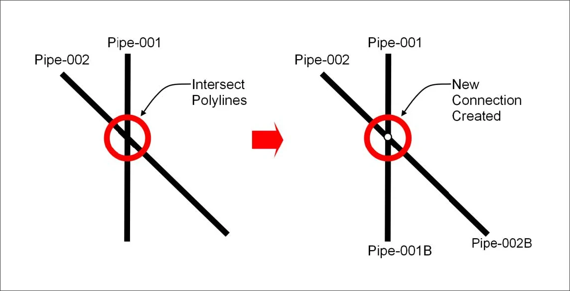
The Intersect Polylines command is used to connect two polylines at the point of intersection, which results in four polylines and a newly inserted junction.
When intersecting 3D polylines, the software automatically interpolates the elevation at the point of intersection based upon the selection order. The first selected polyline is used to interpolate the elevation. The first selected polyline’s interpolated elevation will be assigned at the point of intersection for the other polylines and inserted junction. Note that for 2D polylines, there is no assignment of elevations.
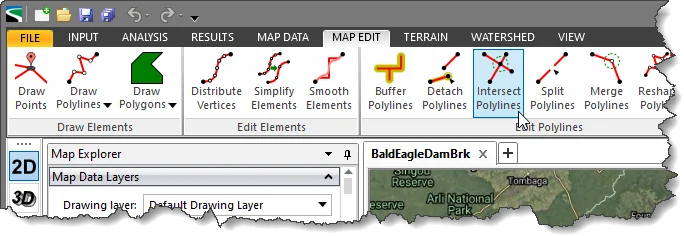
To use the Intersect Polylines command, follow the steps below:
The following sections describe how to interact with the above dialog box.
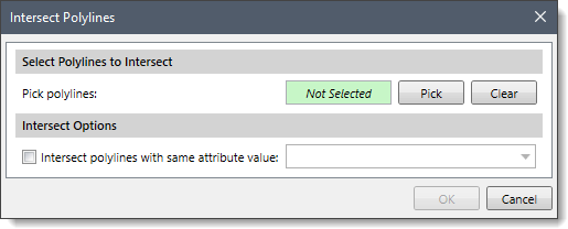
This section is used to manually select the intersected polylines from the Map View. Click the [Pick] button, and the dialog box will temporarily disappear. A prompt will be displayed on the status bar directing the user what to do next. The user can then select the intersecting polylines from the Map View.
Once finished, press the [Enter] key or right-click and select Done from the displayed context menu. The Intersect Polylines dialog box will be redisplayed, and the total number of selected polylines will be shown in the Pick polylines entry, as shown below.
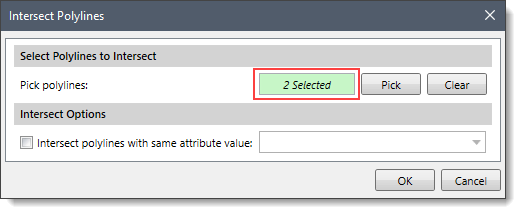
The user can click the [Clear] button to cancel the previous selection and redo the entire process.
Note that the user can also preselect the intersecting polylines from the Map View prior to running this command. If the intersecting polylines were preselected on the Map View, the number of selected polylines will be displayed in the Pick polylines entry.
This section provides Intersect polylines with the same attributes value checkbox option and an attribute dropdown combo box that lists all of the non-geometric attributes for the first selected polylines. If this checkbox is checked and an attribute is selected, then the software will connect polylines and place a junction at the point of intersection only when the selected polylines have the same value for the selected attribute.
Once the data have been properly defined in the Intersect Polylines dialog box, click the [OK] button. The software will insert a junction at the point of intersection on the current drawing layer (if it can support points, otherwise the “Default Drawing Layer” is used), and intersect the selected polylines.


CivilGEO G2 Reviews
4.8/5.0 Rating, Over 230 Reviews

GeoHECRAS is recognized as the top Civil Engineering Design Software with an average of 4.8 out of 5.0 rating from over 230 real user reviews on G2.


We use cookies to give you the best online experience. By agreeing you accept the use of cookies in accordance with our cookie policy.
When you visit any web site, it may store or retrieve information on your browser, mostly in the form of cookies. Control your personal Cookie Services here.


