
Welcome to CivilGEO Knowledge Base
Welcome to CivilGEO Knowledge Base
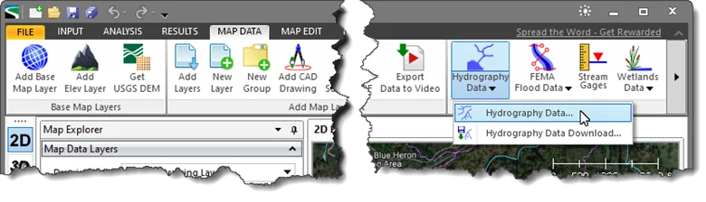
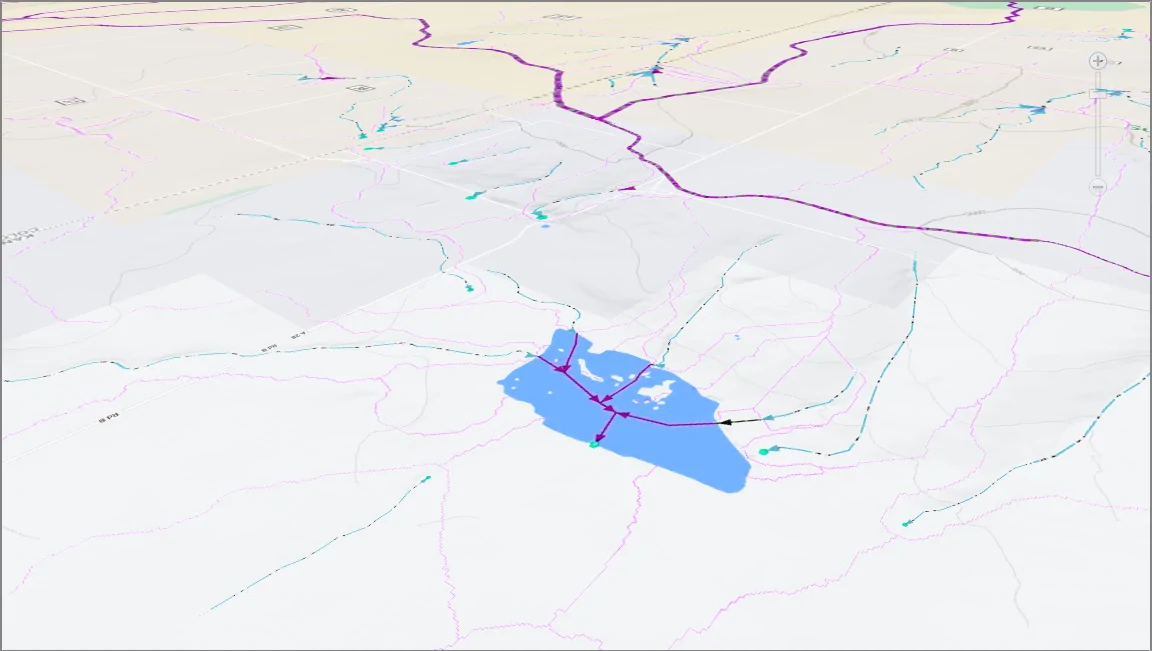
The Hydrography Data command displays the National Hydrograph Dataset Plus High Resolution (NHDPlus HR) from the USGS web map service, showing streams and lakes data on the Map View.
The NHDPlus HR is a geospatial dataset depicting the flow of water across the United States’ landscapes and through the stream network. The NHDPlus HR is built using the National Hydrography Dataset High Resolution data at 1:24,000 scale or finer, the 10 meter 3D Elevation Program data, and the nationally complete Watershed Boundary Dataset.
Note that this command works only within the United States.
Follow the steps below to use the Hydrography Data command:
The following sections describe the Hydrography Data command and how to interact with the above dialog box.
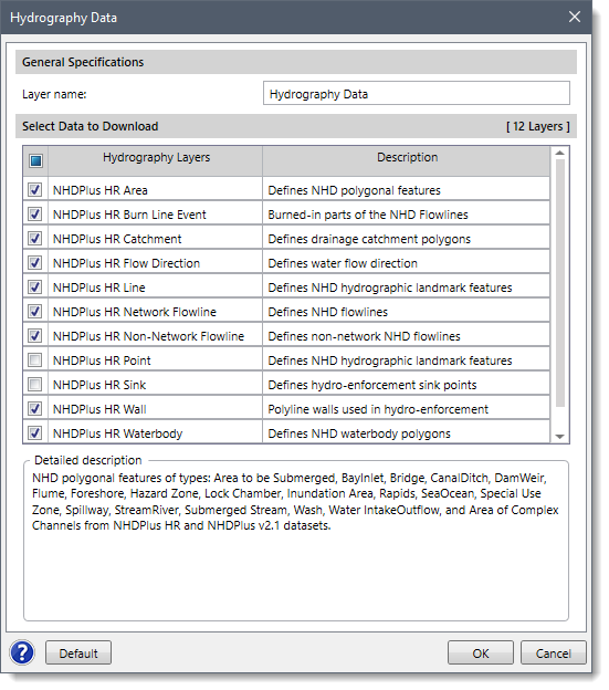
In this section, the user can provide a name for the layer group in the Layer name field. This name identifies the layer group that will be created in the Map Data Layers panel and will contain the downloaded hydrography layers. By default, the layer name is set to Hydrography Data, which can be changed by the user.
In this section, the user can select the hydrography data layers that will be displayed on the Map View. In addition, every hydrography layer consists of a corresponding short description under the Description column. By default, the software selects the basic hydrologic layers. However, the user can experiment with which hydrography layers to display on the Map View.
After the options have been properly defined, the user can click the [OK] button and the software will load and display the selected hydrography layers on the Map View.
To reset the Hydrographic Layers selection to default values, click the [Default] button.
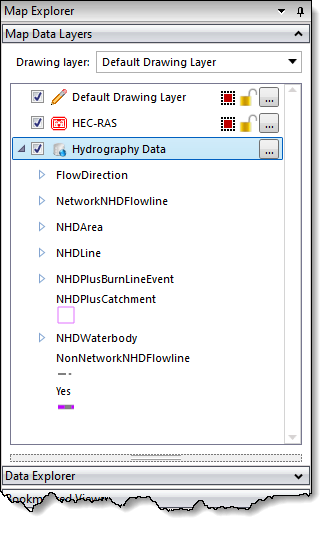
In the Map Data Layers panel, the software provides a data legend for each hydrography layer that lists the hydrography data included within that layer. The user can expand the layer to view the data legend.
The Hydrography Data dropdown menu contains one additional command: Hydrography Data Download.
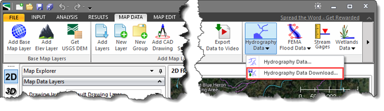 This command allows the user to download USGS hydrography data via the NHDPlus HR web map service as shapefile data. To learn more about this command, refer to this article in our knowledge base.
Note that this command only works within the United States.


CivilGEO G2 Reviews
4.8/5.0 Rating, Over 230 Reviews

GeoHECRAS is recognized as the top Civil Engineering Design Software with an average of 4.8 out of 5.0 rating from over 230 real user reviews on G2.


We use cookies to give you the best online experience. By agreeing you accept the use of cookies in accordance with our cookie policy.
When you visit any web site, it may store or retrieve information on your browser, mostly in the form of cookies. Control your personal Cookie Services here.


