GeoHECHMS is an easy-to-use 2D/3D graphical user interface data wrapper to the US Army Corps of Engineers HEC-HMS. It builds upon the HEC-HMS software and provides a single platform to rapidly construct and visualize a HEC-HMS stormwater model, saving engineer’s time by finishing their work.
GeoHECHMS is 100% compatible with the Army Corps of Engineers HEC-HMS. It provides advanced modeling and visualization, such as ability to work and visualize results on a live 2D or 3D map of your choice (Google Maps, Bing Maps, and many more) by using CAD technology licensed from Autodesk while also providing GIS features and functionality.
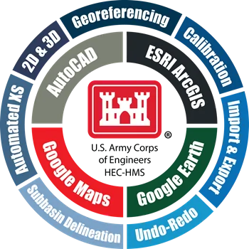
The Army Corps of Engineers HEC-HMS provides you with essential stormwater modeling capabilities, but lacks an easy-to-use graphical interface, CAD and GIS capabilities, 2D/3D capabilities, support for live maps, undo/redo, multiple document interface (MDI), and many other capabilities that are quite common today in other computer software. Earlier, engineers needed at least three separate applications—HEC-HMS, HEC-GeoHMS, and ArcGIS—to get even close to what GeoHECHMS provides with ease.
Following is the list of additional functionalities that GeoHECHMS provides to the Army Corps of Engineers HEC-HMS software:
- Import a variety of different data quickly and easily – Import existing Army Corps HEC-HMS models and quickly georeference them to real-world maps using included georeferencing tools.
- CAD & GIS Integration – Integrate HEC-HMS directly with AutoCAD (including AutoCAD Civil 3D), Bentley MicroStation and ESRI ArcGIS terrain data. Export completed HEC-HMS models and results to AutoCAD, MicroStation and ArcGIS.
- Work Directly on the Map – Blend Google or Microsoft Bing online maps and high-resolution aerial imagery files directly into the HEC-HMS model. Quickly and easily georeference existing HEC-HMS models to background maps, AutoCAD and MicroStation drawings, or ArcGIS map data.
- Automated HEC-HMS Workflows – Speed up stormwater projects with automated workflows to automatically delineate watersheds, compute curve numbers (CN), compute TOC & lag times, compute % impervious, assign design storms, size detention ponds, and generate engineering reports.
- Purpose-Built Stormwater Design Tools – Integrated stormwater design tools offer more efficient ways to create and analyze a stormwater project, size and design detention ponds, analyze dam failures and more. Update subbasin catchment boundaries dynamically as terrain data is changed. Quickly define detention ponds and outlet structures using specialized stormwater tools.
- Automated Watershed Delineation – Automatically delineate subbasins and watersheds from digital terrain models, such as AutoCAD Civil 3D surfaces, MicroStation surfaces, contours, TINs, DTMs, DEMs, survey points, LiDAR, and other external digital elevation terrain data.
- Automated CN & Green Ampt Computations – Quickly compute composite SCS curve numbers (CN), Green Ampt and percent imperviousness based upon aerial mapping, GIS polygon land use, or just by painting regions of land use on the screen. The software will automatically compute a weighted average of the different land uses and assign it to each subbasin.
- Automated TOC & Lag Time – Rapidly compute SCS time of concentration and lag time using flow segments of sheet flow, shallow concentrated flow and channel flow. The software will automatically compute overland flow lengths, slopes and travel times based upon digital terrain surfaces and land use coverages.
- Complete Land Use Coverage – Complete land use coverage is provided for USA, Canada, Europe, Australia and many other parts of the world. This makes it extremely easy to compute composite curve numbers, time of concentrations, lag times and more.
- Complete Imperviousness Coverage – Complete percent imperviousness coverage is provided for the USA, Europe, Australia and many other parts of the world. This allows a more accurate stormwater model to be developed, allowing urbanization effects to be directly incorporated into the stormwater model.
- Integrated Cloud-Based Mapping – Utilize world-wide high-resolution 3D digital elevation terrain data from map services for automated watershed delineation, computation of time of concentration and lag time. Utilize web-based mapping services for aerial orthophotos, FEMA flood maps, watershed delineation, river centerline alignment, and more.
- Digital Terrain Cross Section Cutting – Extract HEC-HMS routing reach cross sections from 3D digital elevation terrain data. Utilize AutoCAD Civil 3D surfaces, MicroStation surfaces, contours, TINs, DTMs, DEMs, survey points, LiDAR, and other external digital elevation terrain data. Automatically convert the extracted cross section to an equivalent 8-point cross section.
- Semi-Automated Detention Pond Design – Quickly size and design detention and retention ponds for different design storms and engineering criteria. Develop outlet structures for different scenarios, considering both water quality and design storm requirements.
- Automated Design Storm Assignment – The software will automatically determine the design storm and corresponding precipitation based upon the project location anywhere within the USA, parts of Canada, Germany, Austria and other parts of the world. It will determine the design rainfall for the 1, 2, 5, 10, 25, 50, 100, and 500-year storms by querying the associated Precipitation Frequency Data Server.
- Automated Sequential Naming – For large models with numerous subbasins, routing reaches, junctions and other stormwater elements, the software will automatically name the elements based upon user-specified guidelines. The elements are named sequentially, by routing distance or incrementally.
- Powerful Report Generation – Comprehensive, easy-to-read input data and output analysis reports are automatically generated using provided drainage report templates. Reports can be customized to meet reviewing agency requirements.
- What-If Scenario Manager Analysis – Compare different engineering models, such as existing and proposed development, different detention pond designs and more. This allows stakeholders to evaluate alternatives, allowing you to consider more innovative and environmentally sensitive designs.
- 2D & 3D Viewing and Editing – Shift seamlessly between 2D and 3D viewing perspectives to clearly identify modeling issues and make changes. Freely rotate, pan, zoom, and fly through the model to any perspective to review subbasins, detention ponds, routing reaches and more.
- MDI Multiple Model Editing – Load, edit, and run multiple HEC-HMS models simultaneously. The Multiple Document Interface (MDI) allows easy copying and pasting between models, quick comparisons of input data and results between scenarios, and other modeling efficiencies. Models can be displayed in tiled windows or tabbed views, providing greater productivity.
- Unlimited Undo and Redo – Correct mistakes easily with unlimited Undo and Redo capability. Experiment with different engineering and management decisions. Rollback changes one at a time or select a group of changes from a visual selection list.
- Seamlessly Share Data with HEC-RAS – To improve productivity, the HEC‑HMS stormwater results computed within GeoHECHMS will seamlessly migrate to HEC-RAS. This greatly increases the speed at which users can perform HEC‑RAS flood studies, design bridge and culvert roadway crossings, compute dam failures, and complete stream restoration and alignment projects.
- Powerful 64-bit, Multi-Core Support – Handle larger projects with powerful 64-bit, multi-core, parallel processing support. This improves performance and stability for memory-intensive tasks—including running HEC-HMS simulations faster.
- Expert Technical Support – Toll-free unlimited technical support by experienced HEC-HMS stormwater modelers is just a phone call away. Quickly resolve your stormwater modeling questions and complete your engineering project—our skilled, professional engineers are here to assist you. Our technical support team is available 24-hours/day Monday-Friday, and by email on weekends


