
Welcome to CivilGEO Knowledge Base
Welcome to CivilGEO Knowledge Base
The Geometry Point Reduction command allows the user to automatically filter out unnecessary station-elevation points for:
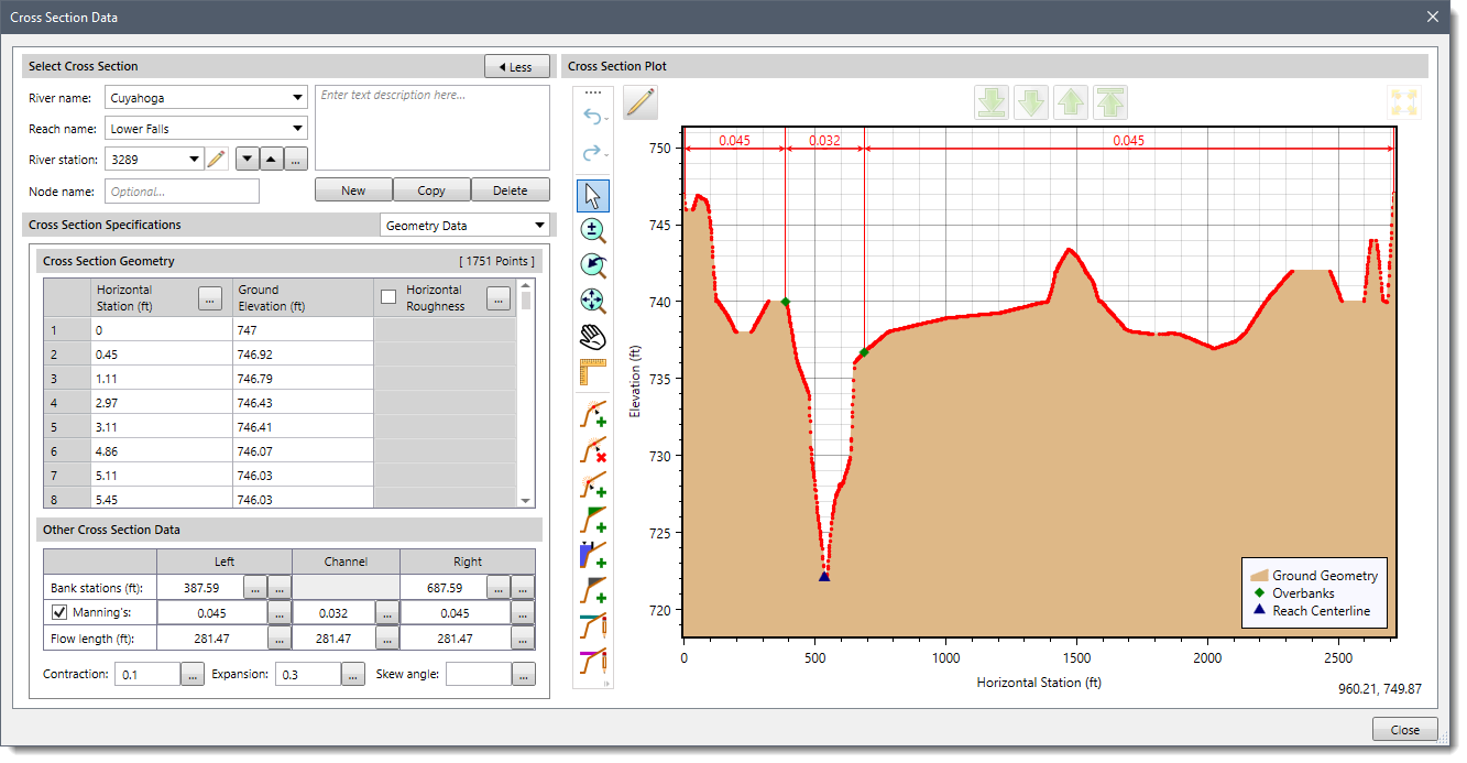
HEC-RAS limits the number of geometry points for cross sections, lateral structures, roadway crossing high chord and low chord geometry, and inline structures to a maximum of 500. This limitation may appear to be large enough, but when these HEC-RAS entities are computer generated from Light Detection and Ranging (LiDAR) or Digital Elevation Models (DEMs), or data is acquired with equipment such as an echo sounder, the number of data points can be fairly high.
GeoHECRAS supports 5000 station-elevation points (HEC-RAS only supports 500). In addition, ineffective flow areas, conveyance obstructions, and levees can insert additional geometry points. Choosing the right data points to keep from among hundreds or thousands of data points can be difficult and time-consuming. GeoHECRAS has made this task easier.
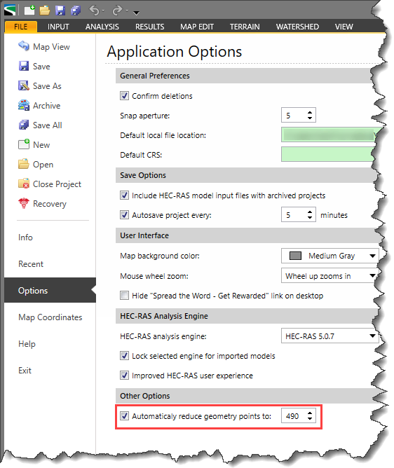
To assist the user, GeoHECRAS provides a checkbox option in the Options backstage page that will prompt the software to always reduce the number of geometry points to 490 points or less when the user creates these HEC-RAS entities. By default, this checkbox option is ON.
Alternatively, the user can manually specify the points in the Cross Section Data, Bridge & Culvert Data, Inline Structure Data, and Lateral Structure Data dialog boxes.
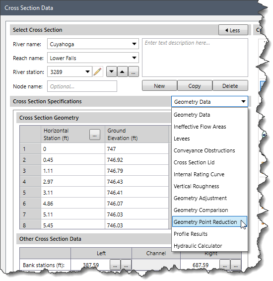
Follow the steps given below to use the Geometry Point Reduction command for cross sections:
The following sections describe how to interact with the above data panel.
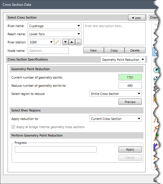
The Current number of geometry points is a read-only field that shows the total number of geometry points associated with the selected cross section.
The Reduce number of geometry points to the entry field allows the user to enter the target numeric value (geometry points) for the cross section. By default, this entry will show 490, but the user can change the value if desired.
The Select region to reduce dropdown allows the user to specify exactly at what part of the cross section the ground geometry (or roadway geometry) point reduction should be applied. The user can choose from the following:
Clicking on the [Preview] button will cause the software to generate a preview of the cross section plot with the reduced number of geometry points.
The Apply reduction to dropdown allows the user to specify the river regions for which the ground geometry point reduction should be applied. The user can choose from the following:
When creating a roadway crossing in HEC-RAS, the software creates a bounding cross section or internal cross sections that are a copy of cross sections just upstream and downstream of the bridge. So, the user can apply this command to those internal cross sections as well by clicking the Apply at bridge internal geometry cross sections checkbox.
This section shows the progress of the reduction of geometry points with the help of a progress bar. Clicking on the [Apply] button will apply the reduced geometry points to the specified cross section. Clicking on the [Cancel] button will abort the process.
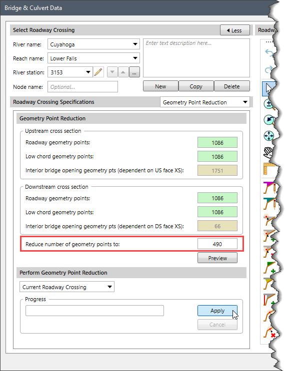
The Bridge & Culvert Data dialog box allows the user to reduce the number of station-elevation points in roadway crossings. Similar to the geometry point reduction performed for cross sections, the user can enter the new station-elevation points count in the Reduce number of geometry points to input field and then click the [Apply] button.
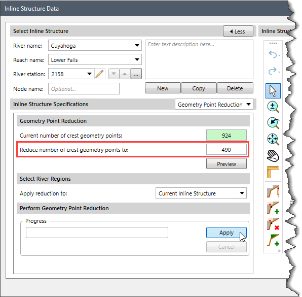
The Inline Structure Data dialog box allows the user to reduce the number of station-elevation points in inline structures. Similar to the geometry point reduction performed for cross sections, the user can enter the new station-elevation points count in the Reduce number of crest geometry points to input field and then click the [Apply] button.
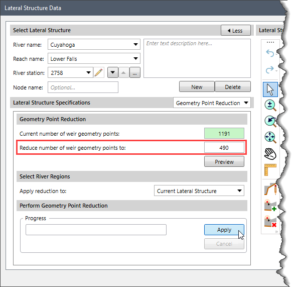
The Lateral Structure Data dialog box allows the user to reduce the number of station-elevation points in lateral structures. Similar to the geometry point reduction performed for cross sections, the user can enter the new station-elevation points count in the Reduce number of weir geometry points to input field and then click the [Apply] button.


CivilGEO G2 Reviews
4.8/5.0 Rating, Over 230 Reviews

GeoHECRAS is recognized as the top Civil Engineering Design Software with an average of 4.8 out of 5.0 rating from over 230 real user reviews on G2.


We use cookies to give you the best online experience. By agreeing you accept the use of cookies in accordance with our cookie policy.
When you visit any web site, it may store or retrieve information on your browser, mostly in the form of cookies. Control your personal Cookie Services here.


