CivilGEO software allows the user to download FEMA National Flood Hazard Layers (NFHL) as shapefile data by using the FEMA Flood Data command. The NFHL is a digital database that contains flood hazard mapping data from FEMA’s National Flood Insurance Program (NFIP). This map data is derived from Flood Insurance Rate Map (FIRM) databases and Letters of Map Revision (LOMRs).
The NFHL provides users with the ability to determine the flood zone, base flood elevation, and floodway status for a specific geographic location.
Note that this command works only within the United States.
Follow the steps below to download the FEMA NFHL data:
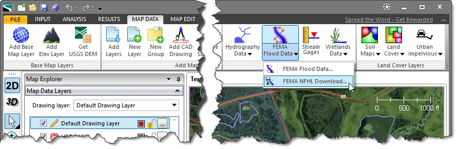
- From the Map Data ribbon menu, click the FEMA Flood Data dropdown menu and then select the FEMA NFHL Download command.
- The FEMA NFHL Download dialog box will be displayed.
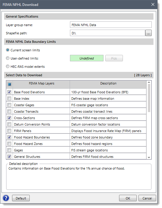
- In the General Specifications section, by default, the Layer group name is FEMA NFHL Data, which can be changed by the user. Click the […] button beside the Shapefile path entry to specify the directory location to save the downloaded GIS shapefiles.
- In the FEMA NFHL Data Boundary Limits section, choose one of the following three options for defining the geographic location:
- Current screen limits: The software will use the existing extent of the Map View screen display as the boundary limit for the FEMA map data to be downloaded.
- User-defined limits: The user can click on the [Pick] button and draw a rectangle on the Map View representing the user-defined limits for the FEMA map data to be downloaded.
- Model extents: If a project model has been defined, this option will create a bounding rectangular region corresponding to the extents of the defined model, plus an additional buffer boundary.
- In the Select Data to Download section, the user can choose various FEMA NFHL elements to download. The user can use the provided default selection as these are typical options used. However, the user can experiment with the various options to customize which FEMA map elements should be downloaded. To return to the default settings, click the [Default] button.
- When the options have been properly defined, click the [OK] button and the software will download the FEMA NFHL data.
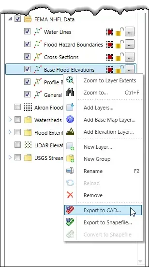
- After the FEMA map data have been downloaded, the software will then load the downloaded FEMA data as a new group in the Map Data Layers panel. Expand the group to see the details of the loaded layers. The user can also export the layers to CAD by right-clicking on a layer and then selecting the Export to CAD command from the displayed context menu.