
Welcome to CivilGEO Knowledge Base
Welcome to CivilGEO Knowledge Base
Once the storage area boundary has been defined, the software will automatically compute the fixed area “footprint” that the storage area occupies. However, defining the storage area volume using this approach results in the treatment of the storage area as a “barrel” with vertical walls—where the storage area does not change with depth.
Refer to this article in our knowledge base to learn about how to define the storage area boundary.
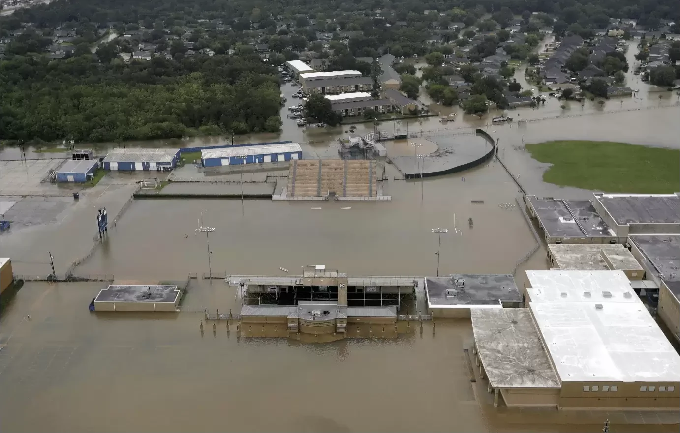
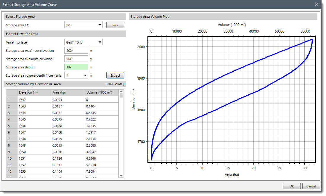
For large storage areas with minimal depth, the fixed area approach is fine. For example, a flat agricultural overbank area can be defined this way. However, there are instances where a more accurate representation of the storage volume is required – such as for a reservoir or detention pond – where the storage area varies greatly with the change in elevation.
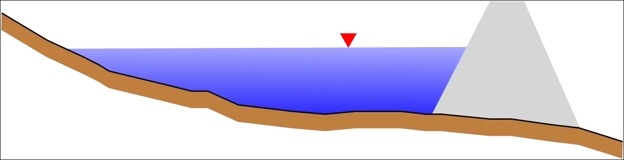
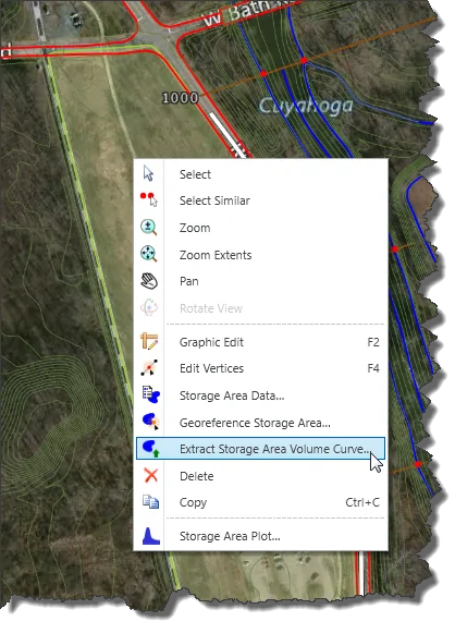
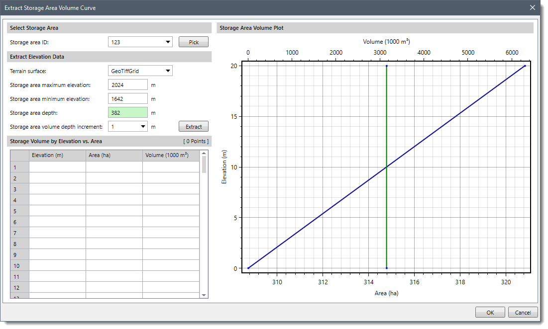
If the terrain model includes the bathymetry of the storage area, then the software can be used to extract the storage volume from the terrain model. Follow these steps:


CivilGEO G2 Reviews
4.8/5.0 Rating, Over 230 Reviews

GeoHECRAS is recognized as the top Civil Engineering Design Software with an average of 4.8 out of 5.0 rating from over 230 real user reviews on G2.


We use cookies to give you the best online experience. By agreeing you accept the use of cookies in accordance with our cookie policy.
When you visit any web site, it may store or retrieve information on your browser, mostly in the form of cookies. Control your personal Cookie Services here.


