
Welcome to CivilGEO Knowledge Base
Welcome to CivilGEO Knowledge Base
Maps are composed of a series of map layers drawn in a particular order. A map layer defines how a GIS dataset is symbolized and labeled in the Map View. Examples of map layers include streams and lakes, terrain, roads, subbasins, building footprints, orthophoto imagery, and more.
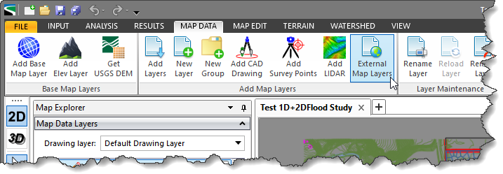
In CivilGEO’s software, the user can use the External Map Layers command to add an additional map layer on the Map View using external map services.
Follow the steps below to use the External Map Layers command:
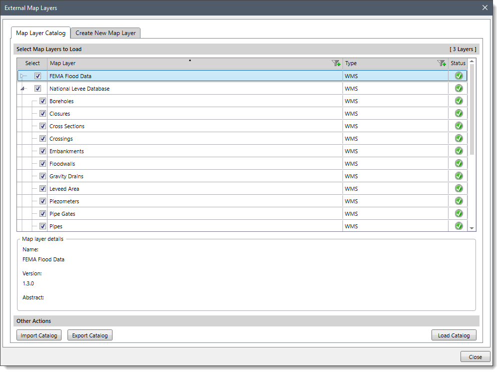
The following sections describe how to use the External Map Layers command and interact with the above dialog box.
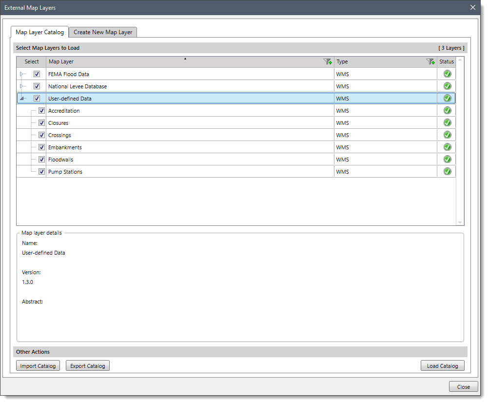
The Map Layer Catalog panel allows the user to add external map layers on the Map View, import the map layer from the catalog file (collection of map files), or export the map layer into the catalog file.
To add additional map layers on the Map View, follow the steps below:
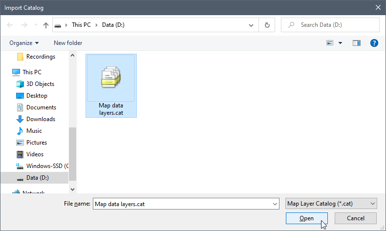
The user can click the [Import Catalog] button to import the map layers on the Map View.
![[Import Catalog] button](/wp-content/uploads/sites/25/2022/06/External-Map-Layers-Command-Image-4.png)
On clicking the [Import Catalog] button, the software will display the Import Catalog dialog box. The user can select the catalog file (it should have a file extension of .cat) and click the [Open] button.
This will add the selected map layer catalog in the Select Map Layers to Load section of the Map Layer Catalog panel. The user can then select the sublayers of this newly added catalog and add them to the Map View.
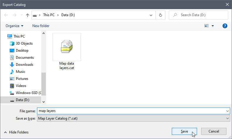
The user can click the [Export Catalog] button to export a map layer in a catalog file.
![[Export Catalog] button](/wp-content/uploads/sites/25/2022/06/External-Map-Layers-Command-Image-6.png)
On clicking the [Export Catalog] button, the software will display the Export Catalog dialog box. The user can browse to the desired location to save the file, enter the file name, and then click the [Save] button to save map layers as a catalog file.
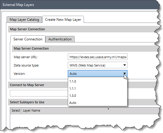
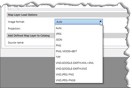
The Create New Map Layer tabbed panel allows the user to create a new map layer using the WMS (Web Map Service) services. A Web Map Service is the standard protocol for transferring map layers over the Internet.
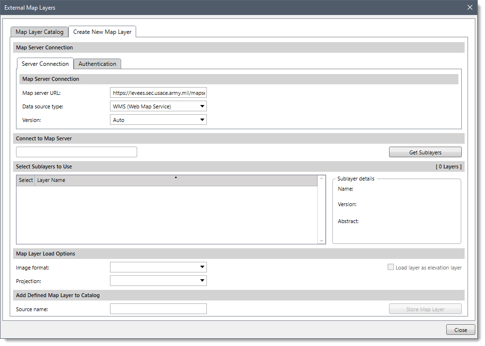
To create a new map layer, follow the steps below:
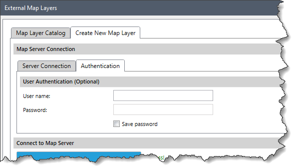
 Sometimes the service requires authentication for establishing the connection. Follow the steps below to authenticate a connection:
![[Get Sublayers] button](/wp-content/uploads/sites/25/2022/06/External-Map-Layers-Command-Image-11.png)


CivilGEO G2 Reviews
4.8/5.0 Rating, Over 230 Reviews

GeoHECRAS is recognized as the top Civil Engineering Design Software with an average of 4.8 out of 5.0 rating from over 230 real user reviews on G2.


We use cookies to give you the best online experience. By agreeing you accept the use of cookies in accordance with our cookie policy.
When you visit any web site, it may store or retrieve information on your browser, mostly in the form of cookies. Control your personal Cookie Services here.


