
Welcome to CivilGEO Knowledge Base
Welcome to CivilGEO Knowledge Base
In GeoHECRAS, the Edit Manning’s Data command is used to manually edit Manning’s roughness so that the computed water surface elevations correspond to observed values.
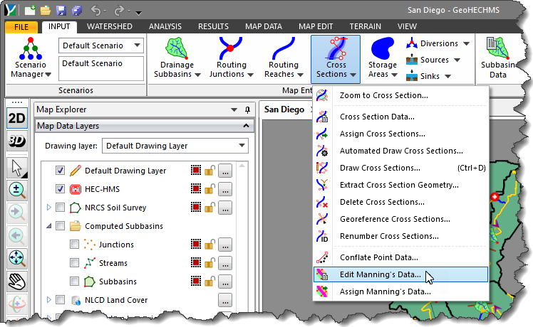
In GeoHECHMS, the Edit Manning’s Data command is used to edit Manning’s roughness for:
Follow the steps below to use the Edit Manning’s Data command in GeoHECRAS:
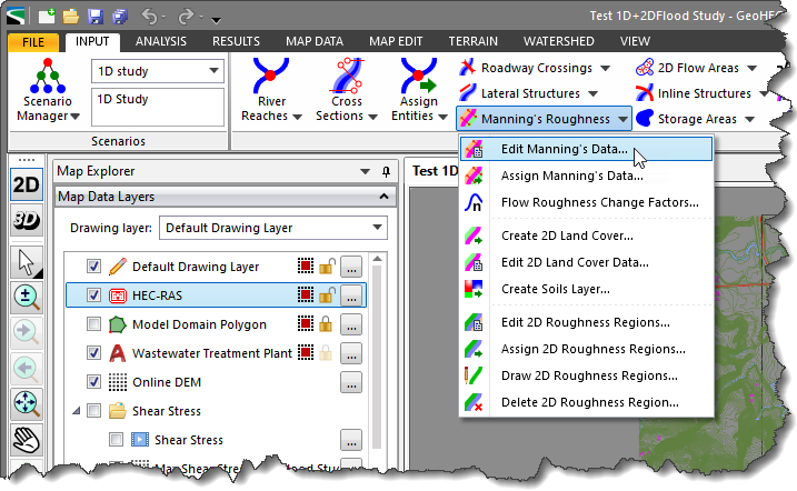
The following sections describe Edit Manning’s Data command in GeoHECRAS and how to interact with the above dialog box.
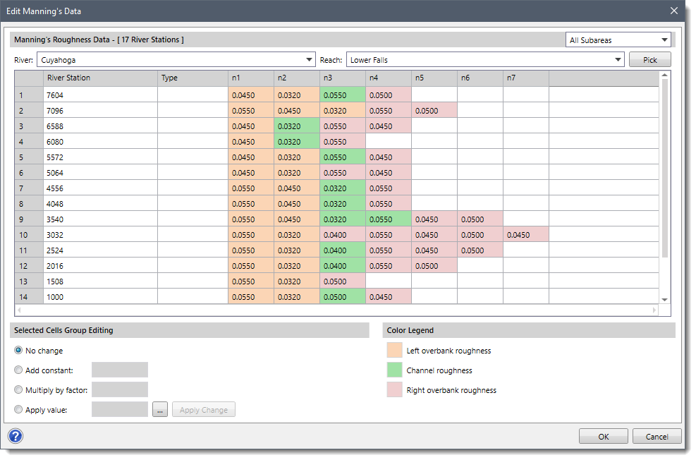
This section is used to select the river and the corresponding reach for editing Manning’s data for the associated cross sections. The user can select the river and the reach from the River and Reach dropdown combo boxes, respectively. Alternatively, the user can click the [Pick] button to select the river reach from the Map View.
The table under this section displays Manning’s roughness (n) of cross sections associated with each River Station.
The structures such as culverts, lateral structures, and roadway crossings falling within the reach are identified and displayed in the Type column. For identified structures, the corresponding rows for Manning’s values will be disabled.
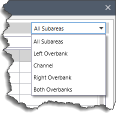
The dropdown combo box present on the Manning’s Roughness Data section header allows the user to filter Manning’s roughness displayed in the table for different regions. The following dropdown entries are available:
Note that while drawing a cross section using the Draw Cross Sections command, the table will only display Manning’s n value for left overbank, channel, and right overbank. Refer to this article in our knowledge base to learn more about Draw Cross Sections command.
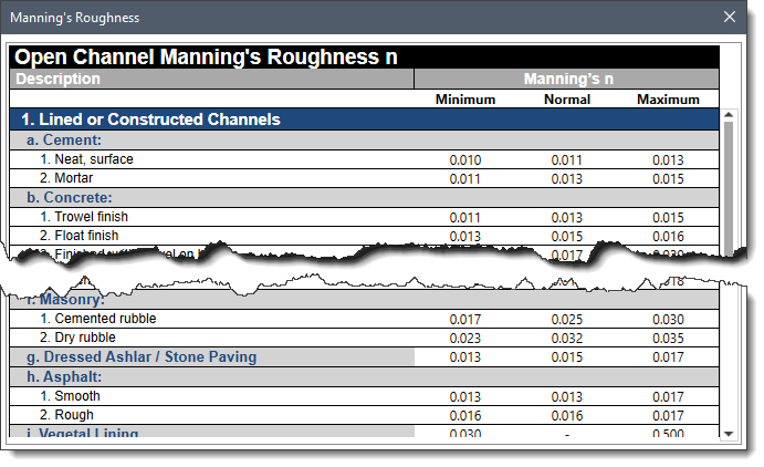
The table will also display Manning’s roughness for additional subareas if different land covers fall over the entire cross section length. The Assign Manning’s Data command gives the option to assign Manning’s roughness based on the NLCD land cover data. Refer to this article in our knowledge base to learn more about Assign Manning’s Data command.
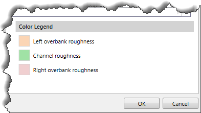
The color codes for different Manning regions displayed in the Manning’s Roughness Data table are listed in this section.
This section provides different options for the user to edit Manning’s data. The user can manually edit a single Manning’s cell value, drag and select multiple cells from a table column, and use the following editing options:
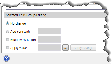
After selecting the desired option and entering the required value, click the [Apply Change] button to accept the changes in the data table.
Once all the editing is done, click the [OK] button to save the changes.
Follow the steps below to use the Edit Manning’s Data command in GeoHECHMS:
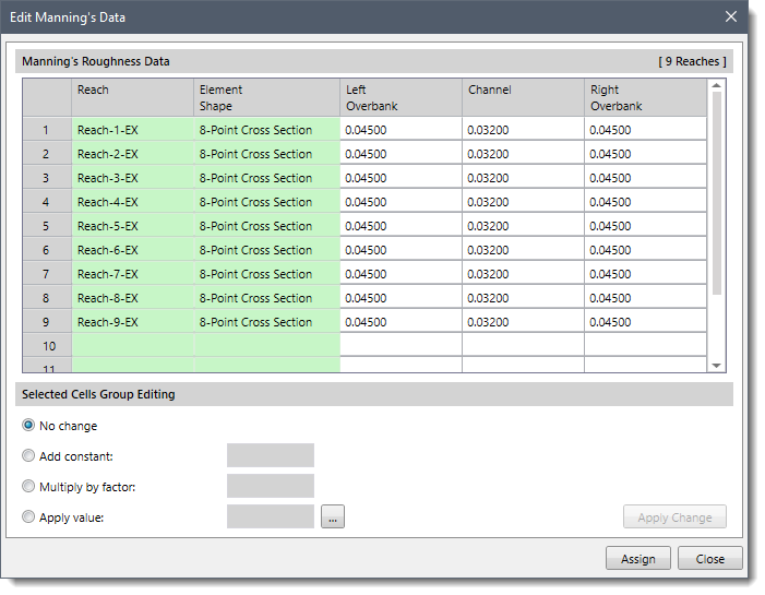
The following sections describe Edit Manning’s Data command in GeoHECHMS and how to interact with the above dialog box.
The data table in this section displays Manning’s roughness of Left Overbank, Channel, and Right Overbank for every cross section associated with a Reach. In addition, the data table also displays the Element Shape of every cross section.
The options and functionality of this section are similar to the Selected Cell Group Editing section as described above for HEC-RAS.
Once all the editing is done, click the [Assign] button to assign the changes.


CivilGEO G2 Reviews
4.8/5.0 Rating, Over 230 Reviews

GeoHECRAS is recognized as the top Civil Engineering Design Software with an average of 4.8 out of 5.0 rating from over 230 real user reviews on G2.


We use cookies to give you the best online experience. By agreeing you accept the use of cookies in accordance with our cookie policy.
When you visit any web site, it may store or retrieve information on your browser, mostly in the form of cookies. Control your personal Cookie Services here.


