
Welcome to CivilGEO Knowledge Base
Welcome to CivilGEO Knowledge Base
In hydrology, a subbasin is used to represent the physical watershed. Subbasins define drainage area polygons that produce runoff to the other elements in the model. In GeoHECHMS, subbasins can be defined by either drawing or assigning polygons on the Map View using the following commands:
When creating a subbasin, the software performs the following tasks:
The Draw Subbasins command allows the user to interactively draw polygons on the Map View as subbasins.
Follow the steps below to use the Draw Subbasins command:
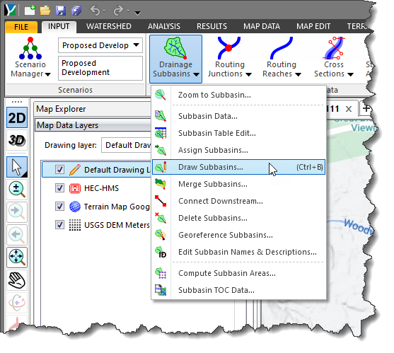
Note that pressing the [Ctrl+B] keys will run the Draw Subbasins command directly on the Map View.
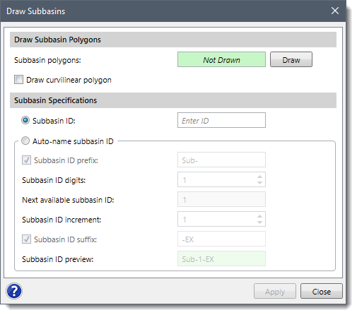
The following sections describe how to use the Draw Subbasins command and interact with the above dialog box.
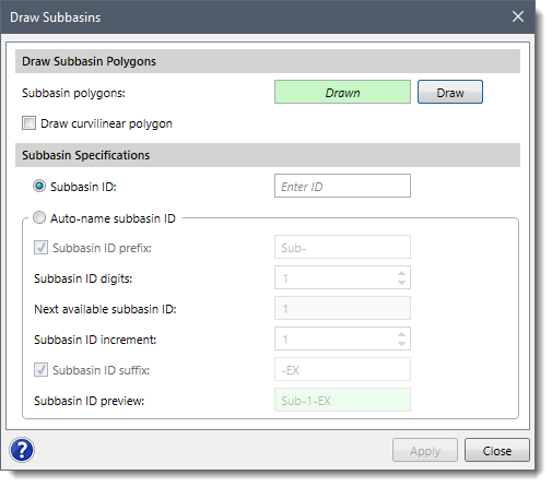
The Draw Subbasin Polygons section is used to draw the subbasins on the Map View using polygons. To draw a subbasin polygon, follow the steps below:
![[Draw] button](/wp-content/uploads/sites/25/2021/04/Draw-and-Assign-Subbasins-Command-Image-3.png)
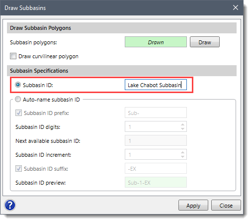
This section is used to specify each drawn subbasin by providing each with an ID. The user can assign these IDs either manually or automatically by using some predefined formats.
Follow the steps below to assign subbasin IDs to the subbasins:
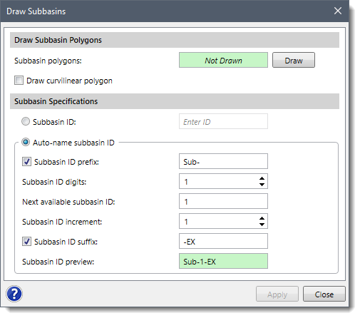 The different subbasin naming formats present in the Auto-name subbasin ID option are as follows:
![[Apply] button](/wp-content/uploads/sites/25/2021/04/Draw-and-Assign-Subbasins-Command-Image-7.png) Note that if the auto-name option is enabled and the user returns to the dialog box, the [Apply] button is disabled since the just drawn subbasins have already been named and created.
Note that if the auto-name option is enabled and the user returns to the dialog box, the [Apply] button is disabled since the just drawn subbasins have already been named and created.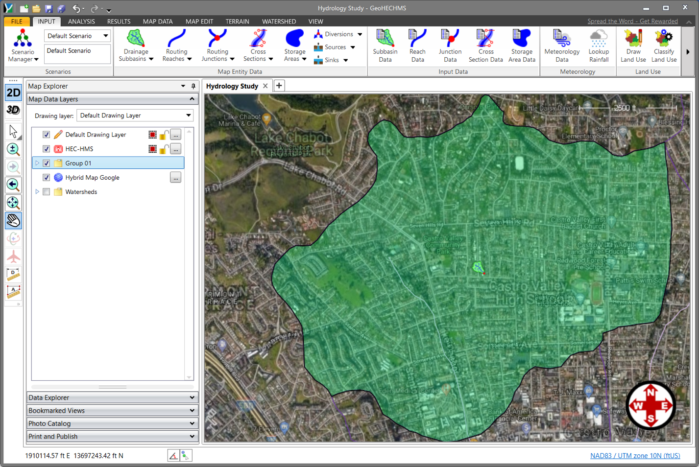
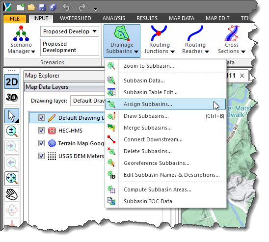
The Assign Subbasins command allows the user to manually associate previously drawn polylines or polygons as subbasins.
Follow the steps below to use the Assign Subbasins command:
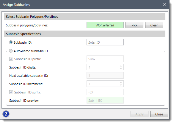
The following sections describe how to use the Assign Subbasins command and interact with the above dialog box.
The Select Subbasin Polygons/Polylines section is used to select the previously drawn polylines/polygons from the Map View to assign them as subbasins.
To assign a subbasin polygon, follow the steps below:
![[Pick] button](/wp-content/uploads/sites/25/2021/04/Draw-and-Assign-Subbasins-Command-Image-11.png)
This section is used to specify an ID for each selected subbasin polygon. The user can assign these IDs either manually or automatically by using some predefined formats.
Note that this section is similar to the Subbasin Specifications of the Draw Subbasins dialog box. Hence, see the second subsection under Drawing Subbasins to learn more about it.


CivilGEO G2 Reviews
4.8/5.0 Rating, Over 230 Reviews

GeoHECRAS is recognized as the top Civil Engineering Design Software with an average of 4.8 out of 5.0 rating from over 230 real user reviews on G2.


We use cookies to give you the best online experience. By agreeing you accept the use of cookies in accordance with our cookie policy.
When you visit any web site, it may store or retrieve information on your browser, mostly in the form of cookies. Control your personal Cookie Services here.


