
Welcome to CivilGEO Knowledge Base
Welcome to CivilGEO Knowledge Base
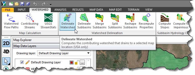
The Delineate Watershed command computes the contributing watershed drainage network that drains to a selected map location (outlet point) on the Map View. The command uses the USGS WMS (Web Map Service) service and the NED (National Elevation Data) to automate the watershed delineation process. The USGS makes a number of their map products available as a WMS (Web Map Service). A Web Map Service (WMS) is an interface that provides maps of geospatial data as well as detailed information on specific features shown on the map. The NED serves as the elevation layer of The National Map and provides basic elevation information for earth science studies and mapping applications in the United States.
Follow the steps below to use the Delineate Watershed command:
The following sections describe how to interact with the above dialog box.
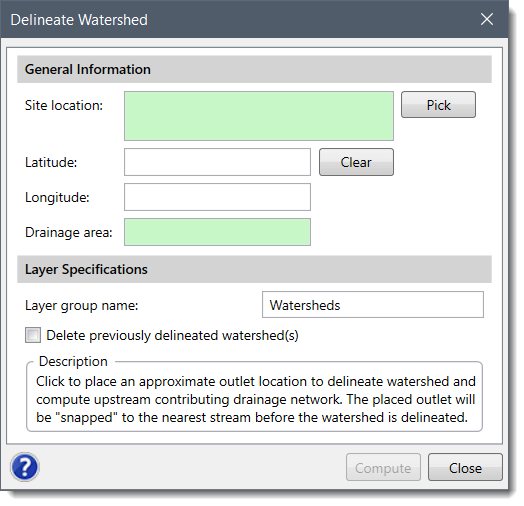
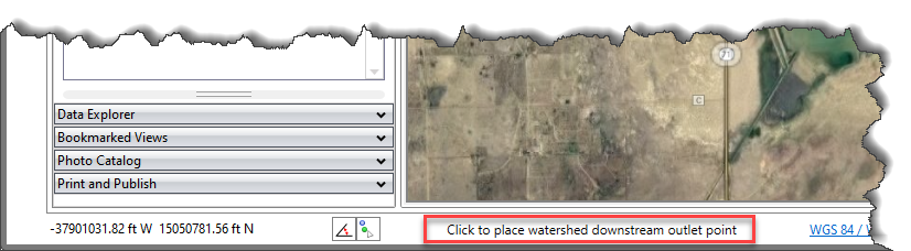
From the Site location section, the user can choose the watershed downstream outlet point location from the Map View. After clicking the [Pick] button, the Delineate Watershed dialog box will temporarily disappear, and a prompt will be displayed on the status bar directing the user to select the watershed downstream outlet point.
The Latitude and Longitude fields will automatically get filled as per the location picked from the Map View The user can also clear the defined site location by using the [Clear] button.
Once the results are computed, the Drainage area field will display the total drainage area of the watershed being delineated.
In this section, the user can define the name of the layer group in the Layer group name input field. This name identifies the layer group that will be created in the Map Data Layers panel that will contain the delineated drainage catchments and stream network. The Delete previously delineated watershed(s) check box can be checked to delete any previously delineated watershed(s) network on the Map View.
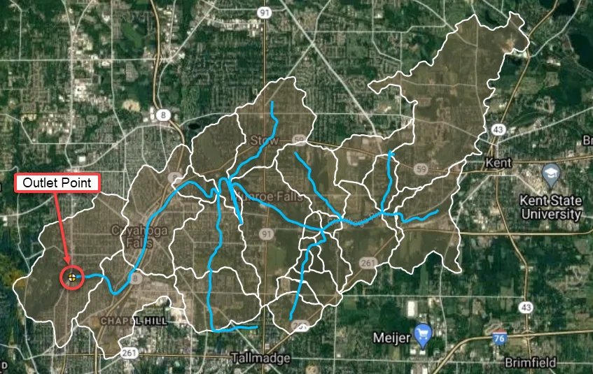
After defining all the required fields, click on the [Compute] button. Internally, the software will then snap the outlet point to the nearest stream, delineate the contributing drainage watersheds, and create the watershed boundaries and upstream drainage tributaries that contribute runoff to the selected location. Once the process is complete, a delineated watershed network will appear on the Map View as shown below.


CivilGEO G2 Reviews
4.8/5.0 Rating, Over 230 Reviews

GeoHECRAS is recognized as the top Civil Engineering Design Software with an average of 4.8 out of 5.0 rating from over 230 real user reviews on G2.


We use cookies to give you the best online experience. By agreeing you accept the use of cookies in accordance with our cookie policy.
When you visit any web site, it may store or retrieve information on your browser, mostly in the form of cookies. Control your personal Cookie Services here.


