
Welcome to CivilGEO Knowledge Base
Welcome to CivilGEO Knowledge Base
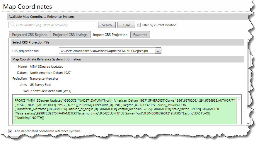
CivilGEO’s software provides support for custom projected coordinate reference systems. Select File | Map Coordinates from the ribbon menu to view the Map Coordinates backstage page. From the Map Coordinates backstage page, select the Import CRS Projection tab.
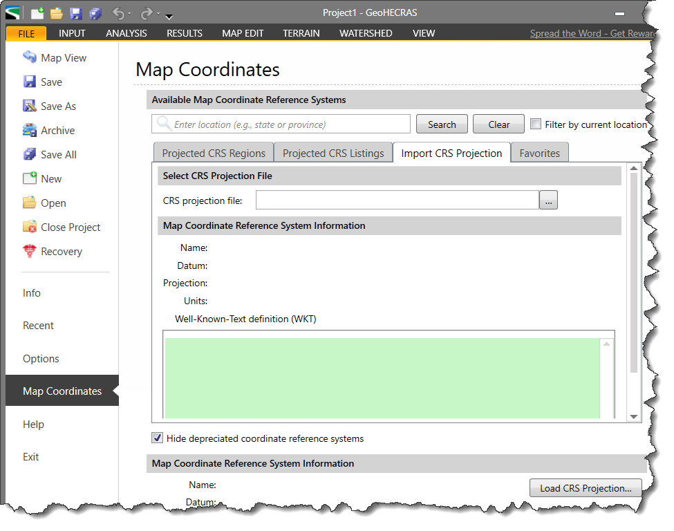
After the custom projection file is loaded, the software will check to see if it already exists in the CRS database. If not, the software will prompt the user to define the physical location of the imported CRS so that it can be readily reused later.


CivilGEO G2 Reviews
4.8/5.0 Rating, Over 230 Reviews

GeoHECRAS is recognized as the top Civil Engineering Design Software with an average of 4.8 out of 5.0 rating from over 230 real user reviews on G2.


We use cookies to give you the best online experience. By agreeing you accept the use of cookies in accordance with our cookie policy.
When you visit any web site, it may store or retrieve information on your browser, mostly in the form of cookies. Control your personal Cookie Services here.


