
Welcome to CivilGEO Knowledge Base
Welcome to CivilGEO Knowledge Base
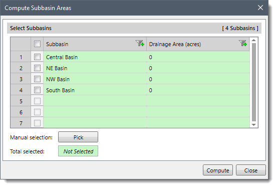
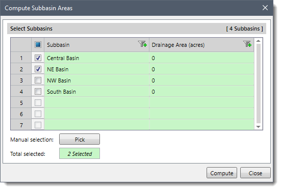
Subbasins define the drainage area polygons that produce runoff to other elements in the model. GeoHECHMS software automatically calculates and assigns the drainage area for the subbasins from the defined subbasin polygon. The user can keep using the polygons or revise the polygons to represent the actual shape of the drainage area. If the user revises the subbasin polygons, then the drainage area value can be recalculated for the corresponding subbasins using the Compute Subbasins Areas command. This command allows the user to compute the drainage area of multiple subbasins simultaneously.
Follow the steps below to use the Compute Subbasin Areas command:

![[Compute] button](/wp-content/uploads/sites/25/2021/12/Compute-Subbasin-Areas-command-Image-4.png)


CivilGEO G2 Reviews
4.8/5.0 Rating, Over 230 Reviews

GeoHECRAS is recognized as the top Civil Engineering Design Software with an average of 4.8 out of 5.0 rating from over 230 real user reviews on G2.


We use cookies to give you the best online experience. By agreeing you accept the use of cookies in accordance with our cookie policy.
When you visit any web site, it may store or retrieve information on your browser, mostly in the form of cookies. Control your personal Cookie Services here.


