
Welcome to CivilGEO Knowledge Base
Welcome to CivilGEO Knowledge Base
An impervious surface is a hard surface that prevents or stops water from entering the soil mantle or causes water to run off the surface in higher amounts or at a faster rate. Common impervious surfaces include rooftops, walkways, patios, driveways, parking lots, storage areas, concrete or asphalt paving, and gravel roads.
During stormwater modeling, impervious surfaces serve as one of the critical factors influencing the rainfall-runoff relationship in urban areas. Impervious surface increases the amount and speed of water entering rivers and other water bodies during a stormwater event and limits the amount of water that can soak into the soil. Impervious surfaces also affect water quality, streamflow, and flooding characteristics of local streams.
In GeoHECHMS, the below listed stormwater loss methods require the user to define the percent of land area that is impervious (e.g., concrete, asphalt, etc.):
Area of land that is impervious is assumed to have no infiltration losses and the loss method is applied only to the remainder of the area.
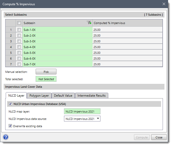
Within GeoHECHMS, the user can automatically compute the percent impervious value (i.e., percent of land area that is impervious) for each subbasin using the Compute % Impervious command. This command utilizes the USGS NLCD web map service data and/or the user-defined GIS polygon shapefile representing the impervious areas to compute the percent impervious value. Additionally, it allows the user to manually provide a default percent impervious value that will be assigned to the remaining areas not covered by NLCD and polygon layers.
The software uses a grid approach to determine the composite imperviousness for each subbasin. In this approach, an internal uniformly spaced cell-centered grid is created to examine fixed points in the subbasins and investigate the corresponding NLCD imperviousness and GIS polygon shapefile value at each point. The grid is traversed row by row, investigating each cell within a row. After processing all the cells, the composite impervious parameter value for each subbasin is computed by the software. While determining the imperviousness value, the GIS polygon layer impervious value has the highest priority, followed by the NLCD impervious value, and then the default impervious value. The command also allows the user to compute intermediate results in the form of shapefile.
After computation, the software automatically populates the computed percent impervious value into the appropriate fields of each HEC-HMS stormwater loss method. Refer to this article in our knowledge base to learn more about HEC-HMS stormwater loss methods.
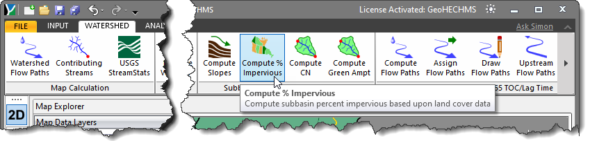
Follow the steps below to use the Compute % Impervious command:
The following sections describe how to compute the % Impervious and interact with the above dialog box.
The Select Subbasins section lists all the subbasins contained within the current scenario.
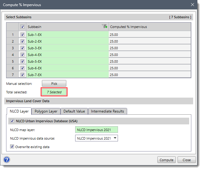
The user can select the subbasins for which the percent impervious value is to be computed. If a subbasin is already selected on the Map View prior to running this command, the same subbasin will be shown selected within the table.
Alternatively, the user can click the [Pick] button to interactively select the subbasins from the Map View. On clicking the [Pick] button, the Compute % Impervious dialog box will temporarily disappear, and a prompt will be displayed on the status bar instructing the user to select subbasins from the Map View. After selecting the subbasins, the user can press the [Enter] key or right-click and choose Done from the displayed context menu. The software will accept the selection of the subbasin and then the dialog box will be redisplayed. The total number of selected subbasins will be displayed in the Total selected entry.
This section consists of four data panels that are used to define the impervious land cover data.
This panel allows the user to utilize the USGS Percent Developed Impervious web map service to compute the percent impervious value for a subbasin.
The name (i.e., NLCD Urban Impervious) displayed in the NLCD map layer read-only field is the default NLCD layer name.
The NLCD impervious data source dropdown combo box allows the user to select which impervious data source to use. By default, the command utilizes the latest available impervious data source. The NLCD impervious data source dropdown combo box contains the following options:
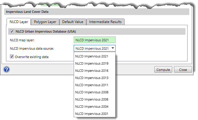
If the “Overwrite existing data” checkbox option is checked, then the new impervious data selected in the NLCD impervious data source dropdown combo box will overwrite the existing impervious data (if one exists).
Note that for countries other than the USA, the NLCD Layer data panel will be replaced by the GMIS Layer data panel. The software will utilize the GMIS urban impervious database for computing % impervious values in these regions.
The user may have a GIS polygon layer that can be used to represent areas of imperviousness. By default, it is assumed that the polygon areas contained within the GIS polygon layer are 100% impervious. However, similar to the USGS Percent Developed Impervious web map service, the software also supports partial imperviousness.
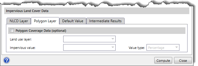
Land use layer
This dropdown combo box allows the user to select the GIS polygon layer included within the project.
Impervious value
This dropdown combo box allows the user to select the corresponding GIS shapefile field that represents the amount of imperviousness for each polygon area.
Value type
This dropdown combo box is used to determine how to apply the defined impervious value for computing the subbasin imperviousness. If the user specifies an impervious value in the above entry, then this dropdown combo box provides the following options:
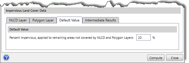
This panel allows the user to define the default percent impervious value for the subbasins. By default, the software uses a value of 20 %. However, if desired, the user can change this value as needed.
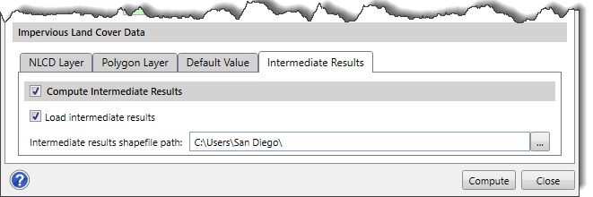
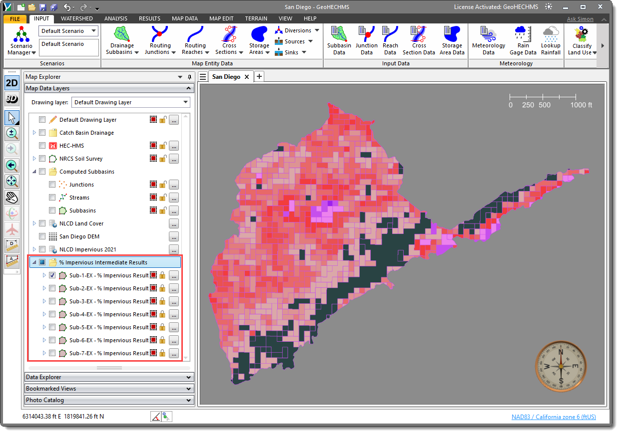
In this panel, the user can compute and save the intermediate results of the subbasin polygons in the form of shapefile. The Compute Intermediate Results checkbox option should be checked before computing the intermediate results. If Load intermediate results option is checked, then the software will create a % Impervious Intermediate Results layer in the Map Data Layers panel that will contain the intermediate results for the selected subbasin(s).
Once the required data has been defined in the Compute % Impervious dialog box, click the [Compute] button.
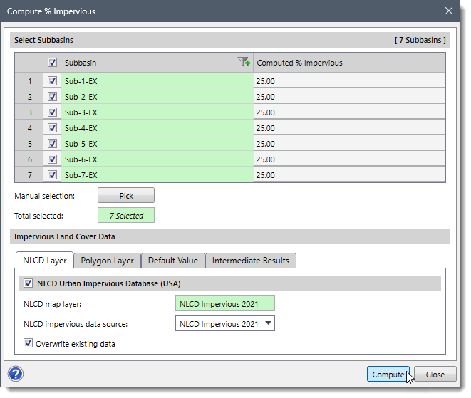
The software will then compute the percent impervious value for each of the selected subbasins. After the computation is done, the computed values will be shown in the Computed % Impervious editable column. The software also allows the user to modify these computed values.
Once the computation is done, all HEC-HMS stormwater loss methods that require the percent impervious value will have the data populated into the appropriate fields.
After computing the % impervious with the intermediate results, the corresponding intermediate results of the subbasin polygons can be viewed in the % Impervious Intermediate Results layer under the Map Data Layers panel.


CivilGEO G2 Reviews
4.8/5.0 Rating, Over 230 Reviews

GeoHECRAS is recognized as the top Civil Engineering Design Software with an average of 4.8 out of 5.0 rating from over 230 real user reviews on G2.


We use cookies to give you the best online experience. By agreeing you accept the use of cookies in accordance with our cookie policy.
When you visit any web site, it may store or retrieve information on your browser, mostly in the form of cookies. Control your personal Cookie Services here.


