
Welcome to CivilGEO Knowledge Base
Welcome to CivilGEO Knowledge Base
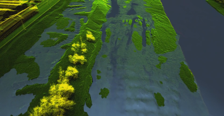
LiDAR has become an established method for collecting very dense and accurate elevation data across landscapes, shallow-water areas, and project sites. Many LiDAR systems operate in the near-infrared region of the electromagnetic spectrum and cannot penetrate water, as shown below. As such, the terrain model is flat in these areas.
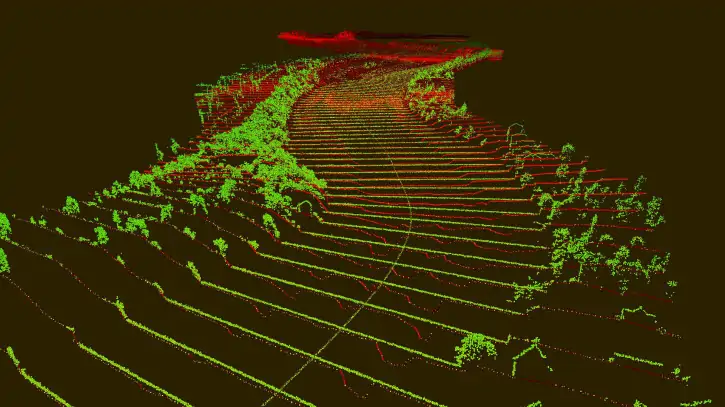
However, some LiDAR sensors operate in the green region of the electromagnetic spectrum and can penetrate water and detect channel bottom features. These bathymetric LiDAR systems can be used in areas with relatively clear water to measure channel bed elevations. However, many times it is necessary to combine survey of airborne LiDAR (green) and sonar (red), as shown below.
In order to reduce bathymetric survey costs, it is only necessary to field survey the river to extract channel cross sections. These channel cross sections can then be merged with overbank cross sections created from a LiDAR derived surface terrain model.
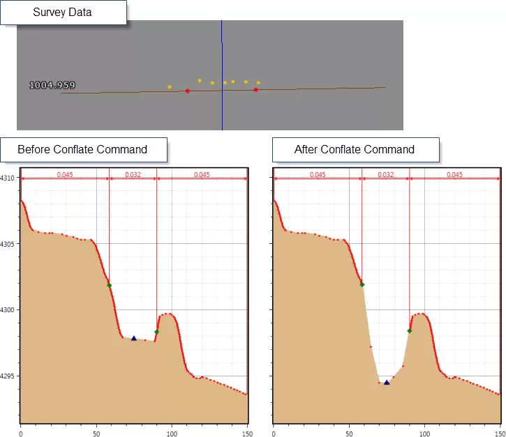
A common problem with surveyed channel cross section data is that surveyed point data do not follow precisely along a straight line across the river, but instead waiver in the X-Y plane. To solve this problem, use the Conflate Point Data command to collapse the surveyed channel cross section data to a selected cross section alignment. Refer to this article in our knowledge base to learn more about Conflate Point Data command.
Below is an example of the Conflate Point Data command using channel survey data for an existing cross section that was originally created using LIDAR data, replacing the channel geometry of the cross section.


CivilGEO G2 Reviews
4.8/5.0 Rating, Over 230 Reviews

GeoHECRAS is recognized as the top Civil Engineering Design Software with an average of 4.8 out of 5.0 rating from over 230 real user reviews on G2.


We use cookies to give you the best online experience. By agreeing you accept the use of cookies in accordance with our cookie policy.
When you visit any web site, it may store or retrieve information on your browser, mostly in the form of cookies. Control your personal Cookie Services here.


