
Welcome to CivilGEO Knowledge Base
Welcome to CivilGEO Knowledge Base
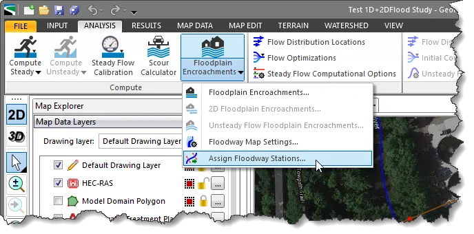
The Assign Floodway Stations command is used to automatically assign floodway stations from GIS polyline or polygon shapefiles to HEC-RAS cross sections for floodway computation encroachment method 1.
Follow the steps below to use the Assign Floodway Stations command:
 Note that if the current scenario is not defined as a steady flow type, the following informational dialog box will be displayed when opening the Assign Floodway Stations dialog box.
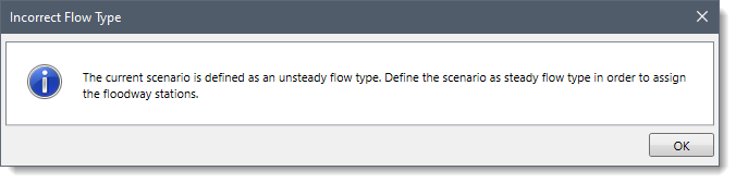
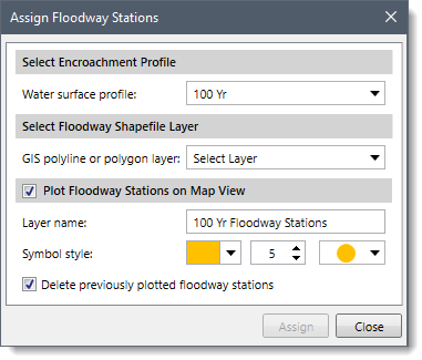
The following sections describe the Assign Floodway Stations command and how to interact with the above dialog box.
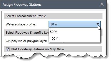
The Select Encroachment Profile section allows the user to select the water surface profile for which the encroachment method 1 floodway station is to be assigned. The Water surface profile dropdown combo box lists all the water surface profiles defined for the current model.
The Select Floodway Shapefile Layer section allows the user to select either a polyline or polygon shapefile layer. The GIS polyline or polygon layer dropdown combo box lists all the GIS shapefile data defined for the current model.
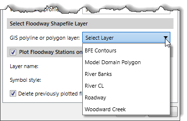
This section allows the user to plot the mapped encroachment floodway stations to the Map View. This will allow the user to validate the encroachment station locations on the Map View relative to the selected GIS shapefile data. By default, the Plot Floodway Stations on Map View section checkbox is checked.
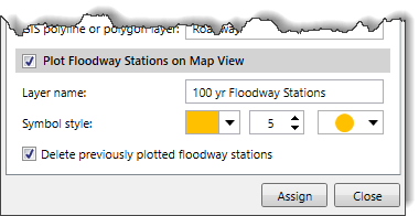
Once the options have been properly defined, click the [Assign] button. The software will assign the selected GIS layer as floodway encroachment stations on the Map View.
![[Assign] button](/wp-content/uploads/sites/25/2022/10/Assign-Floodway-Stations-Command-Image-7.png)
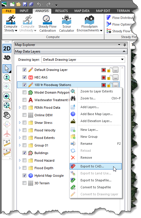
After the floodway encroachment stations have been assigned, the software will then identify the assigned floodway encroachment stations as a new group in the Map Data Layers panel. The user can also export the layers to CAD by selecting the Export to CAD command from the right-click context menu.


CivilGEO G2 Reviews
4.8/5.0 Rating, Over 230 Reviews

GeoHECRAS is recognized as the top Civil Engineering Design Software with an average of 4.8 out of 5.0 rating from over 230 real user reviews on G2.


We use cookies to give you the best online experience. By agreeing you accept the use of cookies in accordance with our cookie policy.
When you visit any web site, it may store or retrieve information on your browser, mostly in the form of cookies. Control your personal Cookie Services here.


