
Welcome to CivilGEO Knowledge Base
Welcome to CivilGEO Knowledge Base
A two-dimensional HEC-RAS model represents the physical conditions and characteristics of a watershed in order to simulate hydrologic and hydraulic processes. A 2D watershed modeling approach in HEC-RAS is being used increasingly to provide economical estimates of flood hazards. This approach can also be used to increase coverage of floodplain mapping and related hazard identification. The user/modeler should follow the below recommendations while preparing a 2D HEC-RAS model.
Consistent management of the 2D HEC-RAS input and output data is important for the reusability of the model. For better project management, the user should develop data in a format that is easily recognizable, storage efficient, and user-friendly for uploading and downloading the project data. While naming the model, the user should always remember that HEC-RAS models, their plans, and other modeling components should be consistent and self-explanatory.
For example, the general naming convention recommends the usage of lowercase characters throughout and underscores rather than spaces, etc. The objective of naming conventions is to allow users to locate and understand the modeling data components quickly, which is especially useful for large scale studies with large file sizes.
A project area may span multiple coordinate projection systems. The user should select one consistent coordinate system and use the same .prj file for all watershed models within the project footprint to avoid variations or mismatching of input and output data. If a single coordinate system for a project area is not possible, then the best practice is to include the coordinate system projection file within the folder that contains the model files so that the .prj file is retained with the model inputs and outputs. Refer to this article to learn more about the project coordinate system.
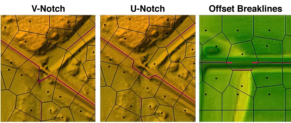
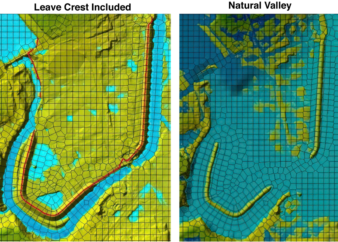
Creating a HEC-RAS 2D mesh that correctly represents the flow area being modeled can take some time due to the need to add the appropriate details to the model to represent the components and due to the terrain data to be included.
The following model mesh development practices are listed in order of importance in 2D watershed modeling:
Unsteady flow data are required to perform an unsteady flow analysis. Unsteady flow data consists of both external and internal boundary conditions. External boundary conditions are required to run an unsteady model. External boundary conditions must be established at all the open ends of the river system being modeled. These are the boundary conditions that the user must add to the upstream and downstream ends of each reach (or 2D flow area). Internal boundary conditions are optional and allow the user to define gate operations and add flow within a river reach. Refer to this article in our knowledge base to learn more about unsteady flow data.
GeoHECRAS software provides some default computational options and tolerances for 1D and 2D unsteady flow models. The tolerances are used in the solution of unsteady flow equations. In general, it is recommended that the default computation options and tolerances be maintained. However, the user can override the default computational options to achieve model stability while maintaining computational accuracy. Extra care should be taken while overriding the default calculation tolerances as it could result in computational errors in the water surface profile. Refer to this article in our knowledge base to learn more about unsteady flow computational options.
Unsteady flow computations can also be performed using 2D floodplain encroachment and unsteady flow floodplain encroachment methods. These methods automate the placement and analysis of floodplain encroachments along the river reach when performing a 2D steady or unsteady flow computation. This allows the user to have a better understanding of the true flow effects when attempting to determine the floodway in a complex flow situation. The user can also examine the DxV (Depth x Velocity) factor, as this directly indicates greater flood hazard and hydraulic importance.
Validation and calibration of rainfall-runoff models provide assurance of accuracy in model results. While the flow routing component of 2D HEC-RAS is much more detailed than a typical rainfall-runoff model, the placement of breaklines and the development of Manning’s n values need to be validated and calibrated (where possible) to confirm realistic results.
Users should inspect the maximum velocities along the stream channels and near hydraulic structures to confirm the reasonability of the results. Typically, velocity issues can be resolved by the following:
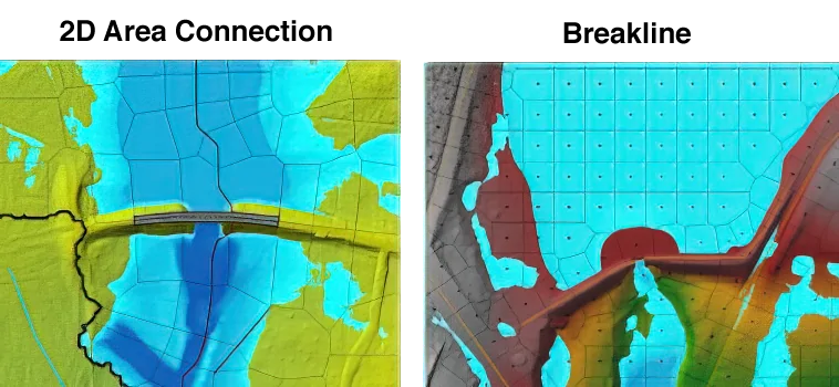
The 2D HEC-RAS modeling is an iterative process. After each simulation, the results should be analyzed and adjustments should be made to verify that the model produces the expected results. The breaklines can significantly influence flow routing and should be modified to allow water to pass through (i.e., hydro-enforcing) the model in a realistic way.
For example, if water is known to pond behind the high ground, this behavior should be consistent with how the mesh and terrain allow the area to drain. After each iteration of mesh refinement, stage and flow hydrograph results in HEC-RAS should be compared to flow and water surface elevation data calculated with USGS gages, regression equations, and rating curves for validation.
After defining the 2D HEC-RAS model and the associated parameters, the analysis should be computed with the incorporated changes in the model. The results for a 2D model can be viewed using the following options:


CivilGEO G2 Reviews
4.8/5.0 Rating, Over 230 Reviews

GeoHECRAS is recognized as the top Civil Engineering Design Software with an average of 4.8 out of 5.0 rating from over 230 real user reviews on G2.


We use cookies to give you the best online experience. By agreeing you accept the use of cookies in accordance with our cookie policy.
When you visit any web site, it may store or retrieve information on your browser, mostly in the form of cookies. Control your personal Cookie Services here.


